ANTIQUE MAPS OF SOUTH AMERICA

This is a selection of our decorative, historical maps of South America.
If you are looking for a particular map please contact us.
Hablamos español.

Ordering and Payment

Lieferbedingungen

Sale! Discount!

30% Discount on All maps with a SOUTHAMERICAMAP number on this page!

Take 30% off the listed price. !

Visit us at the following sites:

https://lovelyantiqueprints.com

twitter.com/philographikon2

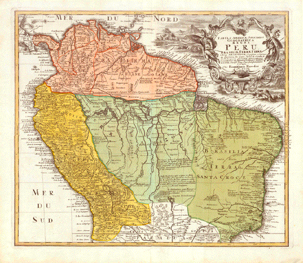
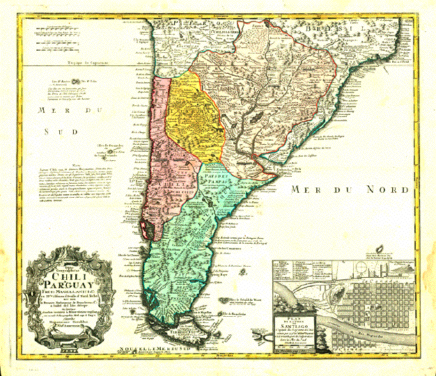
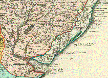
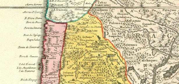
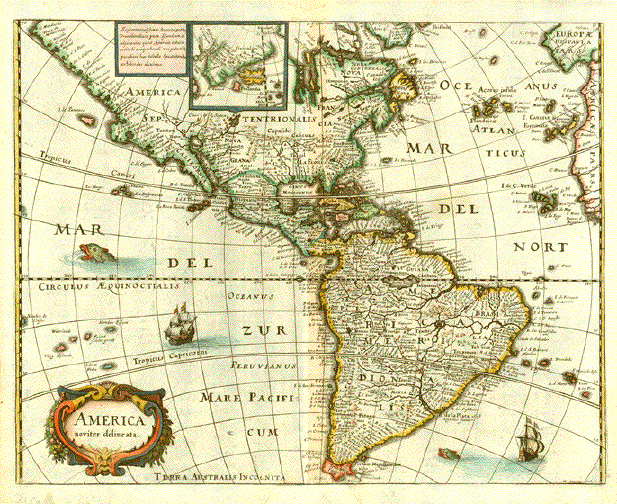
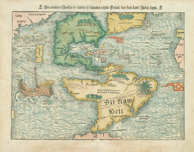
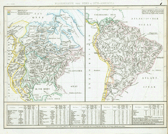
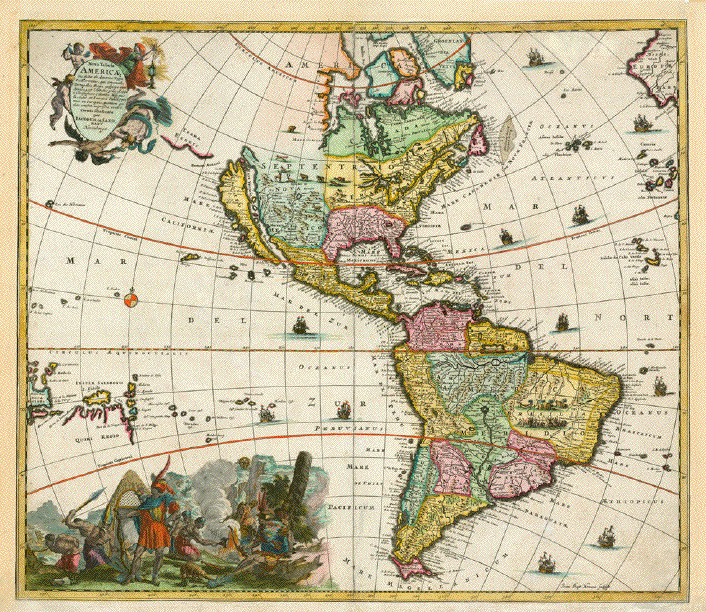
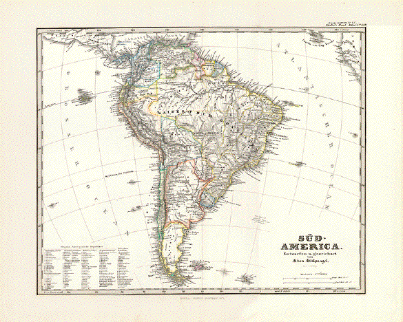
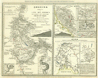
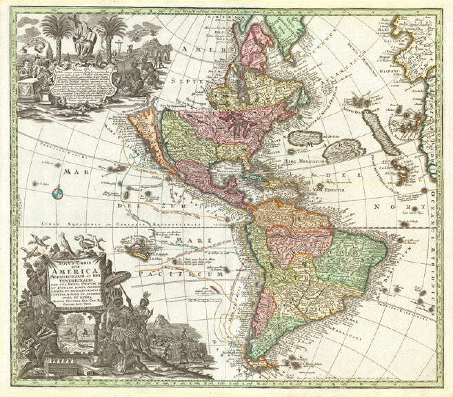
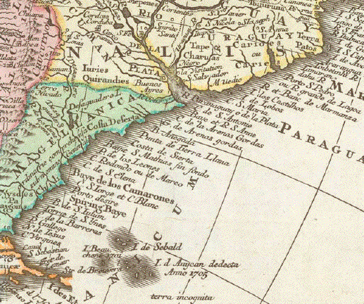
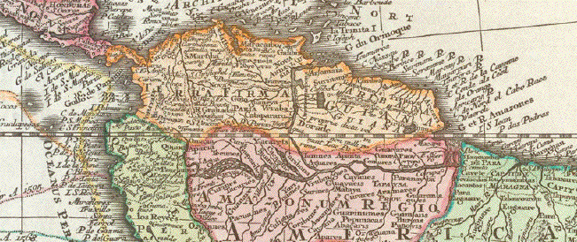
"Novus Orbis sive America Meridionalis et Septentrionalis per sua Regna, Provincia et Insulas iuxta Observationes et Descriptiones et centiss. divisa et adornata cura et opera. Matti. Seutter, Sai. Caes. Maj. Geogr. Aug. Vind."

Copper etching. Very pleasant original hand coloring.

Published in ãAtlas Novus" by Matthaeus Sautter (1678-1757)

Augsburg, ca. 1730

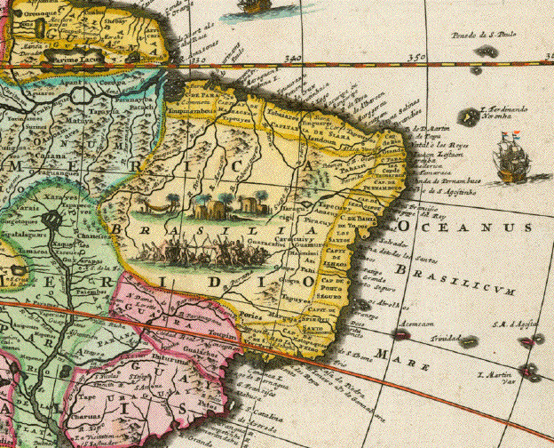
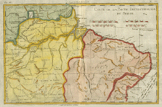
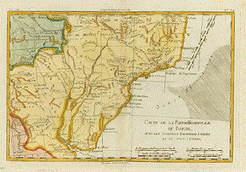
Very attractive map of North and South America with decorative Baroque title cartouche.

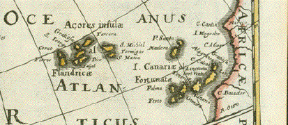
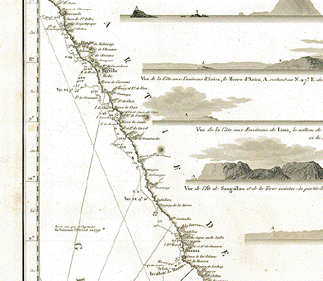
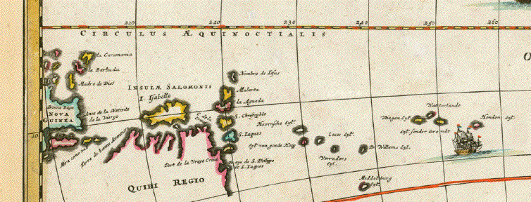
Shows Discovery voyages in the Pacific Ocean by name of explorers and dates.

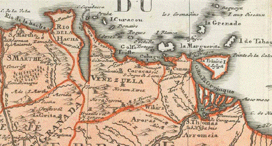
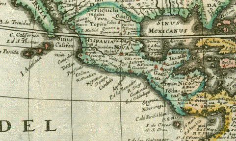
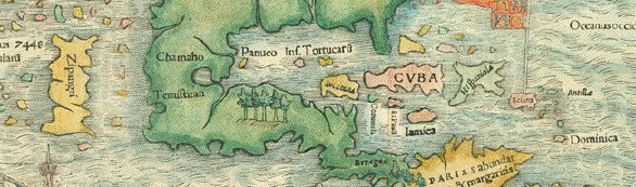
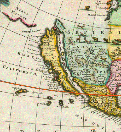
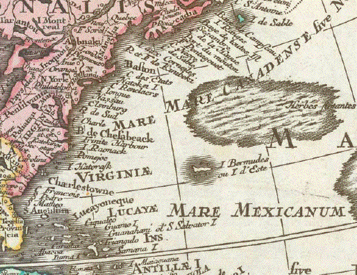
California is shown as an island. Central North America and the West of North America still unexplored.

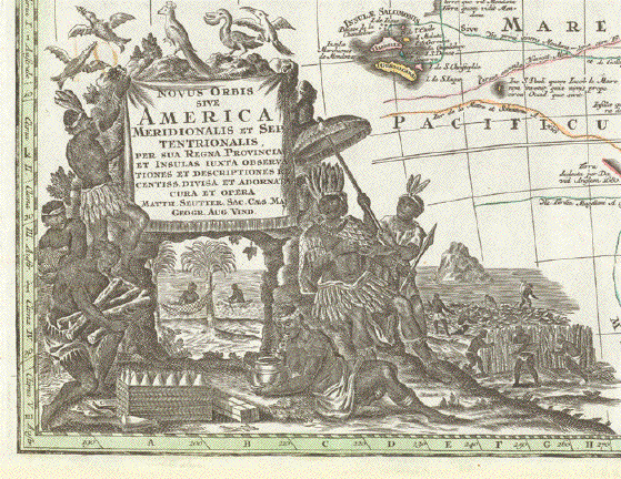
Upper left shows an extra cartouche explaining and demonstrating the Christianization of North and South America

Very good condition. Fresh original hand color. Strong impression. A decisively proud wall decoration.
Vertical centerfold with a few parallel creases new the lower margin.

50 x 57 cm (ca. 19.7 x 22.4")

$ 2200.00 (Please look for discount at top of this page. Here 30% = $ 1540.00)

Order Nr. SOUTHAMERICAMAP255468


"Tabula Americae Specialis Geographica Regni Peru, Brasiliae, Terrae Firmae & Reg. AmazonumÉ"

Originally hand-colored copper etching

Published by the heirs of Johann Baptist Homann

Nuremberg, ca. 1730-35

Detailed map of the Northen half of the South American continent. Map reaches from Panama, Columbia, Venezuela, the Guyanas (then British, Dutch, Surinam and the French overseas department of Guyana), Equador, Peru, Brasilien (most of it, except the southernmost portion) and the northern part of Bolivia. Map reaches just a little south of the Tropic of Cancer. Amazing the run of the Amazon River with all its tributaries and the immenseness of Brazil' rain forest. The Equator runs right through the map. We also see some of the Carabic Islands, such as islands just north of the continent and the coast of Venezuela. St. Vincent and Barbados are the northernmost points. Upper eight has the elaborate baroque title cartouche.

Condition: The original hand coloring is absolutely typical and beautiful. Map has wide margins showing some handling use along their edges. Map is basically clean with only minor traces of age and use. Reverse side has no text print.

48 x 55,2 cm (ca. 18.9 x 21.7")

$ 650.00

Order Nr. SOUTHAMERICA252021


"Schoeners Erdglobus b. J. 1520"

Very interesting historical map made after the globe by Johannes Schoener (1477-1547).

This globe is one of the world's oldest and is in the Historischen Museum von Frankfurt am Main.
The globe is one of the two oldest with the name "America".

This map was published in 1881. Light natural age toning.

Image: 10.5 x 17cm ( 4.1 x 6.6")

Order Nr. WORLDMAP253323SOLD


"Typus Geographicus Chili a Paraguay Freti Magellanici &&&"

Originally hand-colored copper etching.

Published by the heirs of Johann Baptist Homann.

Nuremberg, 1733

This map of the southern portion of South America goes back to a publication

by Guillaume de L'Isle (1675-1726). His map was adopted by the heirs of Johann Baptist Homann and published by them in 1733. Map reaches from just north of the Tripic of Capricorn to Tierra del Fuego (Fire Land) and clearly shows the passage way of Magellan. Map goes out west into the South Pacific including the islands of St. Ambrosio and St. Felix (Chile) as well as the Juan Fernandez Islands Archipelago (Chile). East of the South American continent we see the Falkland Islands (Islas Malvinas). And in the lower right corner of the map we have the "Paln de la Ville de SantiagoÉ" with a legend of prominent city sights. Draw a line from Arica (Chile) on the Pacific to the Archipelago of dos Abrolhos on the Atlantic and you have the northernmost places shown on this map. Neighboring San Sebastian (Brazil) we see the Bay of Rio de Janeiro. The southern part of Brazil and Bolivia as well as all of Paraguay, Uruguay, Is it the Hharvesting of salt which we see at the bottom of the boroque title cartouche? Argentina and Chile we find on this attractive map.

The original hand coloring as well as the impression is very nice. There are some traces of age and use: Water stains in margins, pencil underlinings below some place names and some light spotting in margins and in the Atlantic and Pacific. Actually this is an attractive and decorative map. Reverse side has no print.

48 x 56,3 cm (ca. 18.9 x 22.2")

$ 760.00

Order Nr. SOUTHAMERICA 244114


"Suite du Bresil Depuis la Baye des Tous les Saints jusqu'a St. Paul." Copper etching in recent coloring by Bellin after a map by d'Aneville. Ca. 1755.

This map is a continuation of the above map, reaching as far south as present-day Sao Paulo. It is a very detailed map of the rivers which had been explored by this time. The Río Uruguay flows diagonally north to south in the upper left.

Lower left margin has been reinforced. A vertical and horizontal fold have been smoothed to invisibility. Condition is otherwise Very Good.

23.7 x 16.3 cm ( 9.3 x 6.4 ")

$ 95.00

Order Nr. SOUTHAMERICA 2052


"Suite du Bresil". Copper etching in recent coloring by Bellin after a map by d'Aneville. Ca. 1755.

Again a continuation of the above map. This map reaches south to include part of the coast of Uruguay. At the lower left is the Río de la Plata. What is shown as the very southern part of Brazil is now Uruguay. In the upper left is the Río Paraná and its many tributaries.

A horizontal and vertical fold have been smoothed to invisibility. The condition of this map is Very Good.

23.5 x 17.1 cm ( 9.3 x 6.7 ")

$ 95.00

Order Nr. SOUTHAMERICA 2053


"America noviter delineata"

Copper etching by Matthaeus Merian ( 1593 - 1650 ).

This attractive map shows North abd South America based on the world map by Willem Blaeu.

At the top of the map is a small inset showing Iceland and Greenland.

The Azores, Canary Islands, and Cape Verde Islands are clearly shown off the coast of Africa.

Notice how much of North America is yest to be discovered and mapped.

Map has very pleasant contemporary hand coloring.

This map was published in Frankfurt in 1638.

Map has repairs in the upper and lower margins on the centerfold that are
hardly visible on the front side. Fine image.

27.5 x 36.5 cm ( 10.8 x 13.9 ")

Order Nr. SOUTHAMERICA250780 SOLD

"Die neuwen Inseln so hinder Hispanien gegen Orient bey dem land Indie ligen"

Early map of the Americas. Woodcut published in "Cosmographia" by Sebastian Munster (1488-1552).

This woodcut is from a German edition of the "Cosmographia"

printed in Basel, 1553.

"The "New World", still oddly shaped before mapping got more precise. We have to realize, that the discovery of America was just about half a century before this map was carved into a woodblock and published. But that's the charm of very early map making! In the Caribbean Sea some of the islands were already named and placed fairly accurately: Cuba, Jamaica, Hispaniola. Sciana (now Puerto Rico) carries the pennant of Spain. On the North American (US)-mainland we have only Florida named and shown much larger than the State of Florida comprises in modern times.

For the first time on a map the Pacific Ocean is named as such: Mare pacificum. While South America is definitely recognizable (even the Magellan Strait is mapped), the West Coast of North America is totally undiscovered. An interesting marginal note is the placing and naming of Japan. Japan is shown as one island quite near to North America and iras name is "Zipangri". Name and placement were taken from a globe produced by Johannes Schoener, which is a precious piece of art at the Germanic National Museum in Nuremberg.

Condition: Woodcut has typical but new hand coloring. There is general light age toning. Margins all around show traces of age and use. Lower margin has reinforcements for no obvious reasons, applied probably centuries ago. A slightly visible crease through the Atlantic in lower right corner. Considering the age of the print, it condition is much better than good.

25,7 x 34,2 cm (ca. 10.1 x 13.5")

Order Nr. SOUTHAMERICA251769SOLD

********

Reverse side:


"Flusskarte von Nord u. Sued-America" ( River Map of North and South America )

Steel engraving map ca 1850. Original hand outline coloring.

The maphas no right margin. Small worm hole in upper right corner margin.

Map image: 21 x 27.5 cm ( 8.2 x 10.8 ")

$ 35.00

Order Nr. SOUTHAMERICA250858


Easter Island / Rapanui / Osterinsel / Isla de Pascua / Ile du Pâque /

"Plan de l'Ile de Pâque, levee en Avril 1786 abord des Fregates Francaises la Boussole et l'Astrolabe" / "Plan de Baie de Cook situee a la Cote Occidle. de l'ile de PâqueÉ"

Geographically in Polonesia, politically the island belongs to Chile

Two copper etchings by Barriere.

Published in Atlas du Voyage de la Perouse

Author: Jean-Francois comte de La Perouse (1741-1788)

Paris, 1797

This is the from the Emperial Folio version. Published by the French Navy

Paris, 1821-23

On left side below map: 4 coastline views of the island in profiles.

Very good condition. In bottom marge isolated spots of no importance.to the image.

Overall sheet size: 63,5 x 99,5 cm (ca. 13.8 x 39.2")

$ 1200.00

Order Nr.SOUTHAMERICA248618


"Carte Reduite de la cote occidentale de l'Amerique Depuis 9° de Latitude Nord jusqu'a 7° Latitude Sud Dressee d'apres les Observations Astronomiques et Nautiquesfaites en 1791 par divers Officiers de la Marine d'EspagneÉ"

Copper etching by Vicq in the name of the French King and the Department of the French Navy. It is dated 1821.

On the right of map: Profile views of Island of Gorgona, island of Santa Clara (also named Amortajado), Cap Blanco, Silla de Payta and Fausse Pointe de la Aguja.

Pacific coastline from Golfo Dulce, Costa Rica, Panama, Columbia, Equador, Northern Peru

Also 19 named volcanos in this region. From south: Pillatehiqui, Borma, Cahoapata, Yazuay, Bueran, Quinoaloma, Sangay, Tonguragua, Chimboraso, Hambato, Onetendana, Elenis, Corazon, Sinchul-Agua, Antisana, Pichincha, Cayambe-Urca, Guicocha. (One volcano unnamed near Chimboraso).

The mapping of this coastline was executed by geographic scientists on two corvettes of the Spanish Armada during the year 1791: "Descubierta" and "Atrevida". This expedition was called "Malaspina Expedition" and took place under the command of Captains Alessandro Malaspina and Jose de Bustamente y Guerra during the years 1789-1794.

The expedition began in Cadiz and went to Montevideo, Falkland Islands, Santiago de Chile, Lima, Acapulco, Nootka, Alaska and then continued across the Pacific to Asia, Australia, New Zealand and back to Cadiz.

Minor traces of age and use along margin edges. Otherwise very good. Vertical centerfold.

85 x 56 cm (ca. 33.5 x 22")

$ 1100.00

Order Nr.SOUTHAMERICAMAP248441


"Carte reduite de la Partie de la Cote du Perou Comprise entre le 7e et le 21e Degre de Latitude Sud - Dressee d'apres les Observations Faites par divers Officiers de la Marine d'EspagneÉ"

Copper etching by Vicq in the name of the French King and the Department of the French Navy. It is dated 1821.

In upper part of map profile views of: Truxillo and Island of Guanape, Mesa de Maria, Arica, Coast near Lima Island of Sangallan and Morro de Lechuzas, Punto de la Nasca.

Pacific coastline from Morro de Cherepe Peru all the way along the Peruvian coastline to south of Arica in Chile.

The mapping of this coastline was executed by geographic scientists on two corvettes of the Spanish Armada during the year 1791: "Descubierta" and "Atrevida". This expedition was called "Malaspina Expedition" and took place under the command of Captains Alessandro Malaspina and Jose de Bustamente y Guerra during the years 1789-1794.

The expedition began in Cadiz and went to Montevideo, Falkland Islands, Santiago de Chile, Lima, Acapulco, Nootka, Alaska and then continued across the Pacific to Asia, Australia, New Zealand and back to Cadiz.

Minor traces of age and use along margin edges. Otherwise very good. Vertical centerfold. Number written in red ink.

84,5 x 55 cm (ca. 33.3 x 21.7")

$ 1300.00

Order Nr.SOUTHAMERICAMAP248442


Brasilien

Brasilien

Brasilien

"Ostküste von Brasilien zwischen den 15. und 23. Grad südlicher Breite after the drawing by Arrow-Smith with some corrections."

East coast of Brazil between Rio Pardo and Rio de Janeiro

Copper etching by Leonhard Zertahelly (1787-1854)

Aus Maximilian zu Wied

Munich, 1819

Large and detailed map of the East coast of Brazil.

Clean with some repairs in centerfold. Wide margins.

Map 51 x 42,5 cm (ca. 20 x 16.7")

$ 480.00

Order Nr.SOUTHAMERICAMAP


"Carta dei Paesi sopra il Mare Meridionale da Panama a Guayquil Per la Storia d'America
del Rev. D. Robertson fatta da Tommaso Kitchin il Maggiore Idrografo di sua Maesta Brittanica"

Copper engraving dated September 29, 1777.

Very interesting and detailed map with some of the original names of settlements and topography.

Map has a horizontal fold to fit original book size. Some signs of age and use.

35.5 x 23 cm ( 13.9 x 9 ")

$ 130.00

Order Nr. SOUTHAMERICAMAP242109


"Flusskarte von Nord u. Sued-America" (River map of North and South America)

Steel engraving map publish 1859. Original outline coloring.
Below the map image are tables of the major rivers of the world with statistics
showing length and other information.
Hardly visible vertical centerfold. Small repair in left margin.

Image size including information tables: 20,5 x 28 cm ( 8 x 11")

$ 80.00

Order Nr. SOUTHAMERICA254788


"Colombie et Guyanes par Th. Duvotenay". Steel engraving by Ch. Smith, published in Paris by Maison Bassett, ca 1850. Modern hand coloring.

Colombia, Venezuela and the Guyanas are shown with their political divisions of the time.

Map has a light crease in the upper right corner of the border. Otherwise Very Good condition.

22.9 x 30.5 cm ( 9 x 12 ")

$ 140.00

Order Nr. SOUTHAMERICA 2072

Brazil

"Empire du Bresil". Steel engraving by Ch. Smith, published in Paris by Maison Bassett, ca 1850. Modern hand coloring.

Map like those above with decorative border showing Brazil and surrounding countries.

The left margin is narrower than the other margins. Otherwise the condition is Very Good.

30.7 x 23 cm ( 12 x 9 ")

$ 170.00

Order Nr. SOUTHAMERICA 2073


No title.

Very detailed map of the southermost part of South America and the Falkland Islands.

Hand-colored steel engraving published by Flemming in Glogau ( Germany ) ca 1850.

Very good condition.

34 x 42.8 cm ( 13.3 x 16.8 ")

$ 120.00

Order Nr. SOUTHAMERICA245197


"Verkehrskarte von Amerika"

Chromolithograph mapping the various routes of transportaion in
the Americas. A color key on the left side shows the railway, cabel and telegraph,
roads, shipping and the connecting roads of Eskimo tribes. The various colors of
the lines identify the countries using these routes. The inset in the lower left
shows the trade routes between Cuba, Haiti ad other islands.
Published 1904. Horizontal centerfold.

Image: 29 x 22 cm ( 11.4 x 8.6")

$ 35.00

Order Nr. NORTHAMERICA254004


"Nova Tabula Americae Sic dictae ab Americo Vesptio Florentino qui Emmanuelis Regis auspicijs eam Anno 1497É"

Type of print: Copper etching

Color: Original hand coloring

Author: Jacob von Sandrart (1630-1708)

Engraver: Johann Baptist Homann (1664-1724)

Published separately in Nuremberg, ca. 1697

Characteristics: Very rare map of North and South America. Seldom on the market. With decorative cartouche depicting native Americans in various poses. Map is embellished with indigenous animals of North America, Slave punishment, a battle scene of natives in Brazil, rich sail ship traffic on Atlantic and Pacific, a vague coast line idea of Australia. California is depicted as an island. This map is an early witness of J.B. Homann's mastership in map etching, which, in 1723, he had turned into a profitable business as he produced his famous atlas. Both, Sandrart and Homann were at the crest of German map makers as the center of gravity with regard to map making shifted from Amsterdam to Nuremberg and Augsburg.

Condition: Map is printed on nice thick paper. Left, top and right margins have been professionally added. This individually published map had been bound into a private map collection. On reverse side: No text print. Book joint for private binding. Minimal soiling in margins. Superb original hand coloring.

Order Nr.NORTHSOUTHAMERICA242285 SOLD

"Sued-America Entworfen u. gezeichnet von F. von Stuelpnagel"

Steel engraving by C. Stier for Stieler. Dated 1871. Original outline coloring.

Detailed map of South America showing the Spanish-American republics and their provinces of the time. In the upper right are part of the Cape Verde Islands and Africa. In the lower left above the map key is the Sala and Gomez Island.

Fine, clean map. Vertical centerfold.

29.8 x 36.5 cm ( 11.7 x 14.3 ")

$ 125.00

Order Nr. SOUTHAMERICA238064


ãAmerica"

Type of print: Copper etching

Author: Giovanni Lorenzo d'Anania

Published in: ãL'Universale Fabrivca del Mondo"

Where and when published: Venice, 1600 second state with pagination Fac. 193

Ref.: Burden, entry 54

Condition: Centerfold has been repaired in lower half of map.


Lower margin has been added including some of the longitude figures, which have been partially or complete added by ink.

Upper margin is conically cut towards the letter ãR" in title America.. Title is complete.

Map itself is totally complete. Verso has former owner in ink with no shine-through towards the front. Map is very clean and has good.

Map shows North and South America derived from Abraham Ortelius' earlier map of America.

Measurements including title and graduation: 18.3 x 24.3 cm (ca. 7.2 x 9.6")

$ 1700.00

Order Nr. NORTHAMERICAMAP238447


"Paraquaria vulgo Paraguay cum adjacentibus"

Originally hand-colored copper etching by Gerard Coeck under the direction of Petrus Mortier (1661-1711).

After Mortier's death his widow continued the map printing business.

In 1721 Pierre Mortier's son and Jean Covens continued printing the maps. This map was sold individually by ãChristopher Brown at ye Globe at the west end of Saint Paul's Church" in London (which makes it a rare variant)

Published in Amsterdam by Jean Covens & Corneille Mortier. 1740

No verso text!

This decorative map shows parts of Paraguay, Uruguay, Argentina, Chile and Brazil. The East of the South American coastline begins in San Sebastian in Brazil and goes to the Rio de la Plata. Cities shown are San Vincente, Santos, Concepción and further south Buenos Aires. The coastline on the Pacific Ocean begins in Arica in Peru and goes south to Copiapó in northern Chile.

Two sailships and three Renaissance cartouches enhance the very decorative map, whose original hand-coloring is very attractive: Title - explanitory keys - and a dedication to Vincenzo Carafa (1585-1649), an Italian Jesuit priest and elected Superior General of the Society of Jesus (SJ)

Light general age toning, browning along margin edges. General condition: Very Good.

44,9 x 54,5 cm (17.7 x 21,5")

$ 620.00

Order Nr. SOUTHAMERICA237441


"Sued Amerika, Fluss und Gebirgssysteme"

The map shows the major rivers and mountains of South America.

Wood engraving printed in color 1903. Reverse side is printed. Horizontal centerfold to fit original book size.

26 x 18.5 cm (10.2 x 7.2 ")

$ 30.00

Order Nr. SOUTHAMERICAMAP245633


"Sued Amerika Politische Übersicht"

Map shows the political divisions of South America at the time.

Wood engraving printed in color 1903. Horizontal centerfold to fit original book size.

26 x 20.5 cm (10.2 x 8")

$ 30.00

Order Nr. SOUTHAMERICAMAP245643


America gezeichnet von F. v. Stuelpnagel

"America gezeichnet von F. v. Stuelpnagel"

Steel engraving by W. Behrens after F. von Stuelpnagel, dated 1874.

Clean map image. Some light spotting in margins. Original horizontal centerfold to fit atlas size.

40.5 x 36.5 cm ( 15.9 x 14.3 ")

$ 75.00

Order Nr. SOUTHAMERICA242172


"Carte du Paraguay et des Pays voisins,Pour servir à l'Histoire Générale des Voyages". Copper etching in recent coloring by Bellin. Dated1756.

On the Atlantic coast the map Buenos Aires and Río de la Plata in the south. Rio de Janeiro in the north. On the Pacific coast the map shows much of Peru and part of northern Chile.The river sytems of the Paraná and Paraguay are shown in great detail with the mountainous areas. Most known settlements of the time are shown.

A small hardly visible pleat in right margin outside image. Center fold smoothed to invisibility. Conditon of map is Very Good.

20.5 x 31 cm ( 8.1 x 12.2 ")

$ 150.00

Order Nr. SOUTHAMERICA 2048


"Carte de La Guyane, Pour servir à l'Histoire Générale des Voyages". Copper etching in recent coloring by Bellin after a map by d'Anville (1697-1782). Dated 1757.

Titled "Guyane", this map shows the northeastern coast of South America. In the south it begins with the Araguarí River in Brazil and reaches to the Amacuro River which forms the actual border between Guyana and Venezuela. The windrose and attractive cartouche make this map especially decorative.

Center fold smoothed to invisibility. A second fold parallel to the right and a horizontal fold in the lower half also smoothed to invisibility. Map's condition is Very Good.

23.1 x 32.8 cm ( 9.1 x 12.9 ")

$ 150.00

Order Nr. SOUTHAMERICA 2049


"Paraguay, o Prov. de Rio de la Plata cum regionibus adiacentibus Tucuman et Sta. Cruz de la Sierra"

Copper etching by Johannes Janssonius (1588-1664). With contemporary hand-coloring

Amsterdam, 1647

Map shows Land between Atlantic and Pacific Ocean north and south of Tropic of Capricorn. Center of map is name-giving Paraguay. From the mythical Lago de los Xarayes (in the Brazilian Mato Grosso) along the Rio Paraguay to Corrientes, south of Asunción forming the border between Paraguay and Brazil. Map shows Rio de Janeiro, St. Vincent, Sao Paulo, Parts of Bolivia, Peru, Chile, Argentina and all of Paraguay and Uruguay are on this early map Pacific coastline from north of Arica (Peru) to Santiago de Chile.

This decorative map has Baroque cartouches (title, mileage, and author's signum), a sailship and a compass rose pointing north and east.

General age toning, foxing. Verso text: Latin Wide margins

Traces of age and use. Scattered light spotting.

Map: 37,5 x 47,8 cm (ca. 14.8 x 18.8")

Sheet size: 50,3 x 57,7 cm (18.8 x 22.7")

$ 390.00

Order Nr. SOUTHAMERICA237442


"Chili" (Chile)

Copper etching from the 4-volume atlas by Willem Blaeu. Hand-colored. Verso text in German. Amsterdam, 1641

Santiago bears the old name of ãS. Iago della Nueva Estremadura"

Valparaiso is: ãValParayso". Valdivia is: ãBaldiva"

Very beautiful Renaissance cartouches.

Along the centerfold are minor traces of age. But basically map is in quite desireable condition.

Rare German edition, with beautifully printed Germen text verso.

35.5 x 47.9 cm (14 x 18.9")

Order Nr. SOUTHAMERICA235206 SOLD


"A Chart of the Southern Extremity of America 1775"

Hand colored copper etching. Published by William Stratham. London, 1777

Map is concentrating on the southern part of Patagonia, shared by Chile aynd Argentina as is Tierra del Fuego. Featured especially well are the Falkland Islands with all the little islands around the big ones. There is an inset in the lower right corner focusing on the New Year Isles and the part of Staten Island with New Year Harbour. hermites Island with Cape Horn is also clearly defined on this basically a portolan map.

Map has very pleasant hand coloring. centerfold has been reenforced. Along centerfold are some extra folds (traces of handlin). But the map is generally quite presentable and very interesting for anyone with the love for the southern tip of South America.

42.8 x 50 cm (16.9 x 19.7")

$ 340.00

Order Nr. SOUTHAMERICA235208


"Descrittione dell'America o dell'India occidentale" Plate XXXIIII (34)

Type of print: Copper etching

Artist: Girolamo Porro

After: Giovanni Lorenzo d'Anania

Published in: "Geografia cioe Descrittione Universale della Terra"

Publisher: Gio. Battista & Giorgio Galignani Fratelli

First published in: "Geographia" von Claudius Ptolemy

Edition: Italian edition

Editor: Giovanni Antonio Magini (1555-1617)

Text: Italian. Complete. 8 double pages with the following chapters:

The discovery of America

North America

Quivira ( a legendary area in North America, 1541 mentioned by Francisco Vazquez de Coronado

New Spain (Mexcio)

Nicaragua

Yucatan

Florida

Apalaches (Allegheny Mountains)

Norumbega (a legendary area in NE-USA)

New France (French territories in North America)

Labrador (Canada)

Estotilandia (Labrador, Greenland, Iceland)

Central America

Castella Aurea (Legendary area in Brazil where gold was found)

Peru

Chile

Brazil

Caribic Islands (2 articles)

Published in:Venice

Date:1598

Measurements:

Map size: Ca. 12,5 x 17 cm (ca. 4.9 x 6.7")

Page size: Ca. 28,5 x 19 cm (ca. 11.2 x 7.5")

Condition: Near perfect. Left margin narrow. Very minor traces of age.

Order Nr. NORTHAMERICA236454SOLD


"America Australis" Copper engraving by Heinrich Scherer SJ for"Atlas Novus". Map is dated 1699. Fine, recent hand coloring.

Interesting map of South America with the topography shown in careful detail. Notice the many small inslands shown along the western coast. In the upper right is African Guinea with part of the course of the Niger River. In the lower right are the islands of Tristan de Cunya and Gonzalo Alvarez. In the lower left is the mileage chart with the the Jesuit symbol IHS . Scherer was a Jesuit priest and professor of mathematics in Munich.

Map is clean and in good condition with a strong impression. Two vertical folds as issued.

22.8 x 35.5 cm ( 8.9 x 13.9 ")

$ 390.00

Order Nr. SOUTHAMERICA2125.SOLD


"Carte Particuliere de L'Isle de Juan Fernandés Tirée du Voyage de l'Admiral Anson". Copper etching in recent coloring by Bellin. Ca. 1750.

An extremely decorative map of the little-known Juan Fernández Islands far off the coast of Chile. The top of the map has a fine topographical view of the islands. The windrose and cartouche add classic decoration to this charming map. It's the kind of map that is collected for it´s charm, even if there is no connection to the islands. The main island is shown with the known geography of the time.

Center fold lightly visible. Condition is Very Good.

19.5 x 28 cm ( 7.7 x 11 ")

Order Nr.SOUTHAMERICA 2050SOLD


"Carte de L'Ocean Meridional .....". Copper etching by Bellin. Dated 1746. Modern hand coloring.

The southern Atlantic with boarding continents is the subject of this interesting map showing wind directions. In the lower left is Tierra del Fuego. The South American coast reaches as far north as the mouth of the Amazon River. The African coast is shown from the Equator southward to the Cap de Bonne Esperance. In the lower left is a tiny piece of land titled: Cap de la Circonsision. St. Helana and Tristan d'Acuã are clearly shown along with other smaller islands.

Upper margin has been widened. Almost invisible folds to fit book size. Otherwise Almost Very Good condition.

34.1 x 45.2 cm ( 13.4 x 17.8 ")

Order Nr. ATLANTIC235164SOLD


"Brasilien Entworfen u. gezeichnet Major. C. Radefeld 1851". Steel etching from "Neuster Zeitungs Atlas. Alter und Neuer Erdkunde" by J. Meyer, ca 1855. Original hand coloring.

Clean map in good condition.

25 x 19.3 cm ( 9.8 x 7.5 ")

$ 70.00

Order Nr. SOUTHAMERICA2128


"Die Suedspitze vom Sued America mit Patagonia". Steel etching from "Neuster Zeitungs Atlas. Alter und Neuer Erdkunde" by J. Meyer, ca 1855. Original hand coloring.

Interest map with good detail of the Maldivas (Falkland Islands) and the Georgia and South Shetland Islands. Even the South Orkney Islands are shown in the lower right inset. The map extends as far north as th Negro and Colorado Rivers.

A nice clean map that is very detailed.

25.5 x 19 cm ( 10 x 7.4 ")

$ 70.00

Order Nr. SOUTHAMERICA2129


"America Karte vom Laufe des Orinoco des Atabapo des Casiquiare und des Rio Negro" Steel etching from "Neuster Zeitungs Atlas. Alter und Neuer Erdkunde" by J. Meyer, ca 1855. Some original outline coloring.

This very interesting map shows the tributaries of several major world rivers. On the left side is the Orinoco. The inset in the lower left corner shows the Vasvia section of the river and to the right is a detailed inset of the currant and waterfalls of Maypures. In the upper right is a very detailed section of the Arno and Chian rivers that shows the region from Mt. Cimone as far south as Rome and the mouth of the Tiber. Another inset shows the connection of the Haase and Else with the Weser. In the lower right is Asia with the tributary system of The Irawadi, Panlaun, Mobraeh, Zittaun and Saluaen.

Tiny repaired tear in lower margin.

21.7 x 28.5 cm ( 8.5 x 11.2 ")

Order Nr. SOUTHAMERICA2130SOLD


"Carte Du Nouv. Rme. De Grenade, De La Noule. Andalousie, Et De La Guyane". Copper etching by Rigobert Bonne (1729-1795) for "Atlas de toutes les parties connues du globe terrestre" by Guillaume Thomas Francois Raynal (1713-1796). Published 1780 in Geneva. Modern hand coloring.

Map shows the region from Panama to the mouth of the amazon on the right and the Bay of Guayaquil in the lower left.

Map has a few light spots in left and right margins. Otherwise the condition is Almost Very Good.

20.9 x 31.7 cm ( 8.2 x 12.4 ")

$ 160.00

Order Nr. SOUTHAMERICA 2079


"Carte Du Cours Du Maragnon ou de la Grande Riviere Des Amazones. Dans sa partie navigable depuis Jaen de Bracamoros jusqu'a son Embouchures et qui comprend la Province de Quito, et la Cote de la Guiane depuis le Cap Nord jusqu'a a Essequebe". Copper engraving after the observations by M. de la Condamine made in 1743 and 1744. Published ca 1750. Fine contemporary hand coloring.

Very interesting map showing the course of the great amazon River from its source to its mouth in the Atlantic Ocean. Notice the many tributaries. On the left is Guayaquil and the surrounding area in great detail. Here are the sources of many rivers.

Map was printed with two plates and set together. Vertical fold.

17.5 x 37.8 cm ( 6.8 x 14.8 ")

$ 165.00

Order Nr. SOUTHAMERICA2120 SOLD


"Carte Du Pérou". Copper etching by Benard, ca 1760. Modern hand coloring.

This regional map of South America shows the west coast from Buenaventura in Colombia to Juncal in Chile. At the top of the map is Santa Fe de Bogotá. In the upper right is part of the Río Negro shortly before its confluence with the Amazon. In the southeast is the area slightly to the south of Salta.

Half of the left margin has been added where the map was bound. Repaired tear in left margin on horizontal centerfold. (reaches into yellow margin). Creasing in lower right margin (one crease reaches ca 2 cm into map image. Overall condition is Better than Good.

36.6 x 20.7 cm ( 14.4 x 8.1 ")

$ 145.00

Order Nr. SOUTHAMERICA 2066


ãKarte der Magellanischen Strasse von Herrn Don Juan de La Cruz Cano y Olmedillo Mitglied der Ferdinandischen Akademie zu Madrid 1769 an das Licht gestellet, und nach den Beobachtungen der Herrn Byron, Wallis, Carteret und Bougainville verbessert und vermehret. Nedu herausgegeben von Herrn FR.A. Schaembl MDCCLXXXVII (1787)."

Copper etching by Joseph Gerstner. Single sheet print. Vienna, 1787. Slight green borderline coloring.

Very detailed, large map of the Strait of Magellan. With an inset map showing Patagonia and Tierra del Fuego including the Falkland Islands to give the viewer a perspective as to where in the world to find the Strait of Magellan.

51 x 68 cm ( 20 x 26.8")

$ 780.00

Order Nr. SOUTHAMERICA2118


"Brazil". Steel map engraving by J. Rapkin. Illustrations engraved by W. Lacey after H. Winkles. Original hand outline coloring.

Illustrations: Boats on the Río Negro, St. Catharina, Monte Video, Cap St. antonio Bahia, Rio De Janeiro.

Map has horizontal centerfol. Light browning on margin edges from framing.

34 x 23.5 cm ( 13.3 x 9.2 ")

$ 85.00

Order Nr. SOUTHAMERICA2108


"Carte du Pérou avec une partie des Pays qui en sont à l'est". Copper etching by Rigobert Bonne (1729-1795) for "Atlas de toutes les parties connues du globe terrestre" by Guillaume Thomas Francois Raynal (1713-1796). Published 1780 in Geneva. Modern hand coloring.

Peru and the mouth of th Amazon with its many tributaries is the subject of this map. In the upper left is Punta de Manglares and Cabo de San Francisco. At the bottom center of the map is Puerto Betas and Puerto Juncal just south of the Tropic of Capricorn. The names of many native tribes are shown in their respective locations.

Hardly visible horizontal centerfold. General condition is Almost Very Good.

31.7 x 21 cm ( 12.4 x 8.2 ")

$ 120.00

Order Nr. SOUTHAMERICA 2103


"Carte du Perou Avec Une Partie Des Pays Qui Sont À L'Est". Copper etching by Rigobert Bonne (1729-1795) for "Atlas de toutes les parties connues du globe terrestre" by Guillaume Thomas Francois Raynal (1713-1796). Published 1780 in Geneva. Modern hand coloring.

This detailed map shows the west coast of South America from Juncal in Chile as far north as Cabo Manglares in Colombia. In the lower right corner is Salta and in the northeast is part of the Amazon river. The names of many native tribes are shown on the map.

Map has overall toning. Except for minimal offsetting, the map is in Very Good condition.

31.5 x 21.2 cm (12.4 x 8.3 ")

$ 120.00

Order Nr. SOUTHAMERICA 2067


"Carte de L'Amérique Méridionaledresée et dessinée Sous La Direction de Mr. J.G. Barbie du Bocage". Steel engraving by Ch. Smith, published in Paris by Maison Bassett, ca 1850. Modern hand coloring.

An attractive map with a decorative border. In the lower left corner is an inset with the Shetland and Orkney islands near the Antarctic Circle.

Map is in Very good condition.

30.5 x 22.5 cm ( 12 x 8.8 ")

$ 160.00

Order Nr. SOUTHAMERICA 2071


"Karte Von Guyana". Copper etching for a German atlas after Jean Baptiste Bourgiunnon D'Anville (1697-1782). Published ca 1750. Modern hand coloring.

This map shows the northeastern coast of South America. In the south it begins with the Araguarí River in Brazil and reaches to the Amacuro River which forms the actual border between Guyana and Venezuela. The windrose and attractive cartouche make this map especially decorative.

Map has vertical folds to fit book size. Upper and right margins are narrower (ca 1 cm ). Light fraying on upper margin edge. A few scattered spots, especially in upper right part of image.

20.2 x 30.9 cm ( 7.9 x 12.1 ")

$ 130.00

Order Nr. SOUTHAMERICA 2089


"Carte du Bresil, Prem Partie. Depuiis la Rívíere des Amazones jusquà la Baye de Tous les Saints". Copper etching in recent coloring by Bellin after a map by d'Aneville. Ca. 1755.

The title is very precise in the description of this map showing part of the Brazilian coast from the mouth of the Amazon in the north to the Bay of present-day Salvador. Many of the small coastal settlements are shown as well as rivers. A caption tells us that the inland is unknown and that the inhabitants are known as Tapuyas. The attractive cartouche adds a decorative note.

"Copper engraving. Light browing on margin edges. Vertical centerfold and one horizontal fold to fit original atlas size.

Map image: 24 x 32.5 cm ( 9.4 x 12.7 ")"

$130.00

Order Nr. SOUTHAMERICA250444


"Carte du Bresil. Prem. Partie. Depuis la riviere des Amazones jusquÔà la Baie de Tous les Saints...." Copper etching by A. v. Krevelt. Published in Amsterdam, 1772.

The margins to the right and left are very wide. General condition is Almost Very Good.

23.6 x 32.1 cm ( 9.3 x 12.6 ")

$ 180.00

Order Nr. SOUTHAMERICA 2070


"Carte de La Partie Septrionale du Bresil". Copper etching by Rigobert Bonne (1729-1795) for "Atlas de toutes les parties connues du globe terrestre" by Guillaume Thomas Francois Raynal (1713-1796). Published 1780 in Geneva. Modern hand coloring.

This map shows the northern part of Brazil. The Amazon river and its tributaries dominates the upper part. In the lower part of the map is Matto Grosso. In the lower right are arrows showing wind directions during certain months of the year.

Map is in Very Good Condition.

20.3 x 31.2 cm ( 7.9 x 12.2 ")

$ 140.00

Order Nr. SOUTHAMERICA 2078


"Carte De La Partie Meridionale Du Bresil". Copper etching by Rigobert Bonne (1729-1795) for "Atlas de toutes les parties connues du globe terrestre" by Guillaume Thomas Francois Raynal (1713-1796). Published 1780 in Geneva. Modern hand coloring.

This map is the southern partner to the map shown above. The coastal area shown extens from Porto Seguro in the north to Río de la Plata in the south. In the upper left is Moxos Province.

Map has a hardly visible vertical centerfold. Some spotting on margin edges.

20.9 x 31.7 cm ( 8.2 x 12.4 ")

$140.00

Order Nr. SOUTHAMERICA2115


"Verfolg Von Brasilien von der aller Heiligen bis nach St. Paul". Copper etching for a German atlas after Jean Baptiste Bourgiunnon D'Anville (1697-1782). Published ca 1750. Modern hand coloring.

Map shows the Brazilian coast from San Salvador in the north as far south as Sao Paulo. In the upper left is the San Franciso River.

Map has overall age toning and a few scattered spots. One hardly visible horizontal fold to fit book size in lower area. Overall condition is Better than Good.

23 x 16.5 cm ( 9 x 6.5 ")

$ 120.00

Order Nr. SOUTHAMERICA 2087


"Fortsetzung von Brasilien zur allgemeinen Historie der Reisen" Copper etching for a German atlas after Jean Baptiste Bourgiunnon D'Anville (1697-1782). Published ca 1750. Modern hand coloring.

This map is a continuation of the above map showing the coast of Brazil from the Isubey River in the north south to Uruguay and Rio de la Plata.

Map has overall age toning and a few scattered spots. One hardly visible horizontal fold to fit book size in lower area. Light crease above title cartouche. Overall condition is Better than Good.

23 x 16.5 cm ( 9 x 6.5 ")

$ 120.00

Order Nr. SOUTHAMERICA 2088


More Maps of South America - page 2

Maps of the World

Views of South America

Views of Brazil

Scenes and Costumes of South America

Ordering and Payment

E-mail

Terms of sale - Lieferbedingungen

Return to Home Page

Impressum

Datenschutz

© Rainer Rauhut