Antique Maps of Romania (Rumania)

Please let us know if you are looking for special maps. All maps are in good condition unless otherwise mentioned.

Ordering and Payment

Lieferbedingungen

Sale! Discount!

30% Discount on All maps with a ROMANIAMAP number on this page!

Take 30% off the listed price. !

Visit us at the following sites:

https://lovelyantiqueprints.com

twitter.com/philographikon2

We accept reasonable offers.

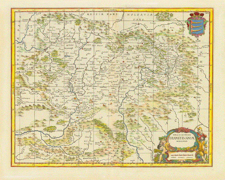
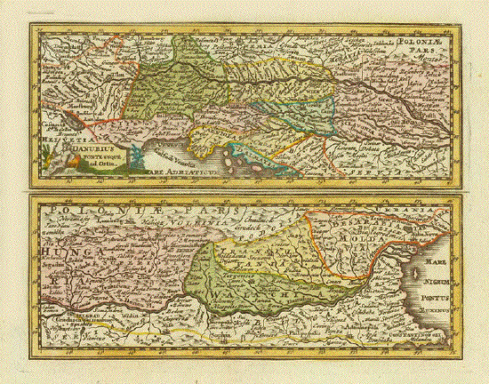
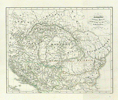
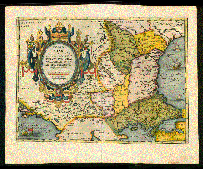
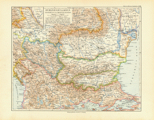
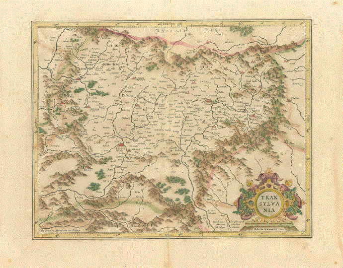
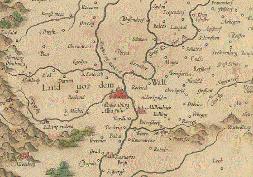
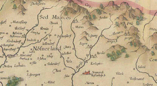
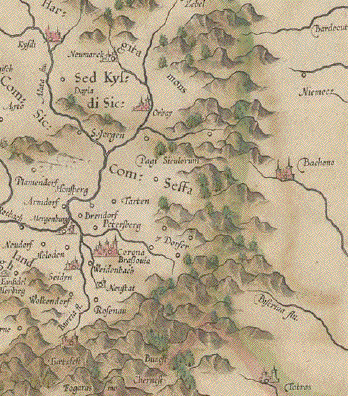
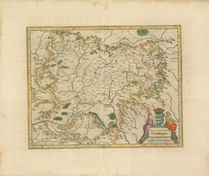
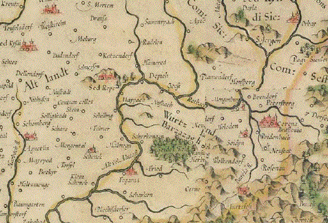
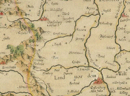
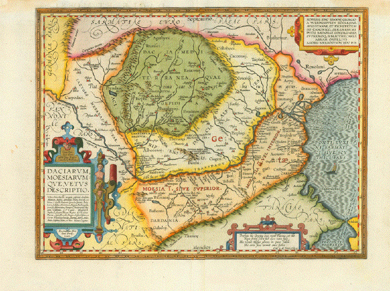
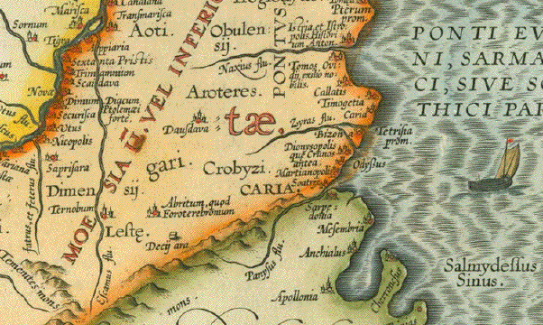
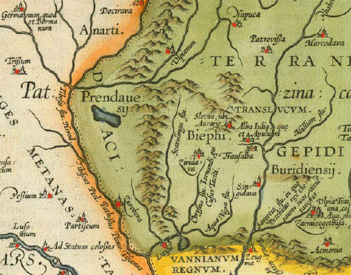
"Daciarum, Moesiarumque, vetus descriptio"

Cpper etching from "Theatrum orbis terrarum" by Abraham Ortelius.
<<published in Antwerp 1595. Attractive hand coloring.

Abraham Ortelius did this fine 
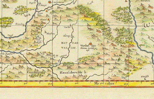
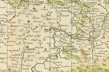
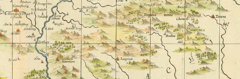
map himself. The map shows present-day Romania
and Bulgaria. It extends as far south as the Bosphorus by Istanbul.
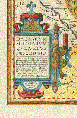
The map is decorated with three Renaissance cartouches.
The title cartouche on the left side has a saying of Ovid and
the cartouche in the upper right has a dedication.
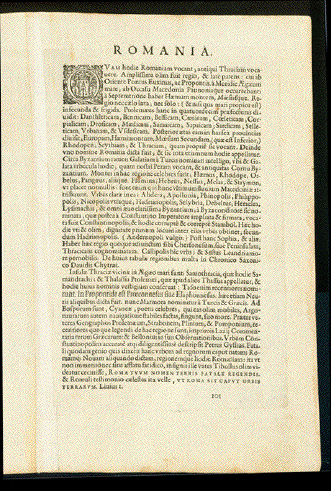
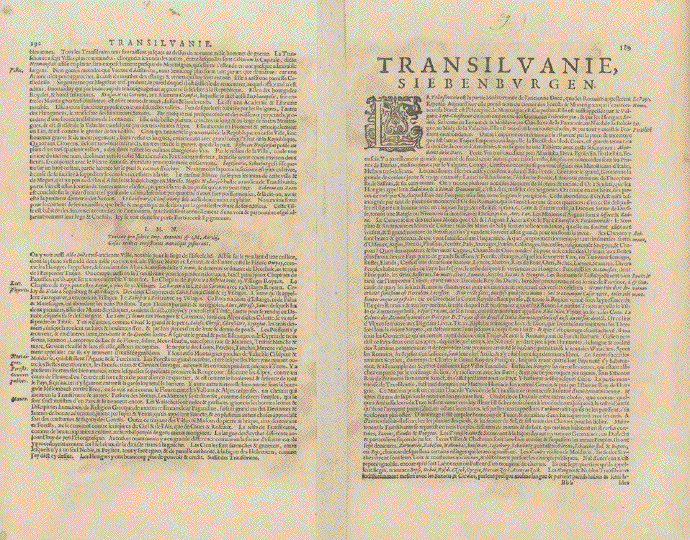
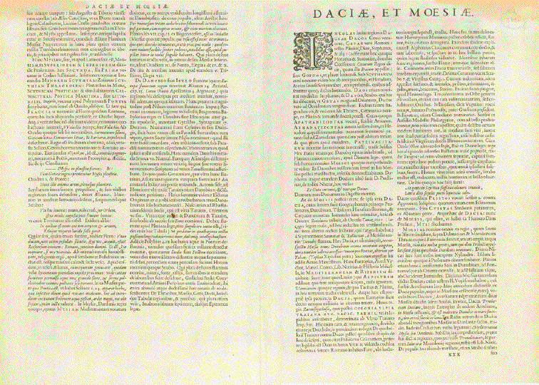
Verso: Text in Latin.

Overall condition is Very Good. Map has light toning in margins.
Vertical centerfold.

Image: 35 x 45.5 cm (13.7 x 17.9")
Page size: 42 x 58.5 cm ( 16.5 x 23")

$ 1080.00 minus 30% discount = $ 756.00

Order Nr. ROMANIA255005


"Nova et Accurata Transylvaniae Descriptio"

In the center of the map is Agnetlin. In the upper left corner is
Zatmarbanya. On the right side of the map is the Aluta (Olt) River
and its many tributaries

Hand-colored copper etching

Verso: No text

Published by Jan Janssonius (1588-1664)

Amsterdam, ca. 1665

Centerfold: Upper part reenforced on reverse side.
Repair in upprt margin on centerfold.
An attractive map with a few signs of age and use.

39.8 x 49 cm ( 15,6 x 19.2")

$ 510.00 - 8See discount at top of page)

Order Nr. ROMANIAMAP248905


"Thraciae Descriptio"

Cluver, Philipp (1580 - 1623) was an early author of historic maps.
His works were published long after his lifespan. This map( comes from a pocket size atlas (duodez):
Philippi Cluverii. Introductionis inUniversam Geographiam tam veterem quam novam Libri. Amsterdam, 1661.
The engraver was Peter Bertius (1565 - 1629). Originally colored.

The side margins have been added. Minimal foxing.

Size: ca.12 x 12.5 cm (ca.4.72 x 4.92").

$ 130.00

Order Nr. BALKANMAP249819


"Turquie D'Europe"

Steel engraving map, 1862. Shows Balkan and Greee at the time of Turkish domination.

Vertical folds to fit original book size. Right and lower margins have ben added.

Some signs of age and use in margins.

17.5 x 23 cm ( 6.8 x 9 ")

$ 70.00

Order Nr. TURKEYMAP255101


"Black Sea - River Danube Mouth of the Kilia Branch. By the Engineers of the

Russian Government 1894"

Lithograph by J. & C. Walker. London

The Romanian part of the Danube delta near Sulima. With a city plan of Sulima and

with an inset of "Serpent Island"

London Hydrographic Office of the Admirality, 1853. This map based on the survey by

Captain Spratt and was amended in 1885 and in 1898.

This print was published in 1900.

Nautical map. Maps like this served river ship captains for navigation..

Map shows some traces of age and use.

Map: 60.5 x 45.8 cm (23.8 x 18")

$ 290.00

Order Nr. ROMANIAMAP255022


"Danubius Fonte ad Osdtia"

The course of the River Danube from source to mouth in the Black Sea.

Copper etching. Original hand color.

By Peter van der Kererre (Latinized: Petrus Kaerius (1570-1630)

Published in "Atlas Minor" (Small hand atlas) by Mercator/Hondius

Amsterdam, 1607

Minor signs of age and use in margins. Hardly visible vertical centrfold.

Page size: 17 x 20.5 cm ( 6.6 x 8.4")

$195.00

Order Nr. DEUTSCHLAND250405


ãDie Laender der unteren Donau vom Vten bis in das Xte Jahrhundert".

Countries along the lower Danube from the 5th into the 10th century.

Steel etching by W. Alt. 1846. Faint borderline coloring.

Clean.

Page size: 37 x 43.8 cm (14.6 x 17.2").

$ 180.00

Order Nr. BULGARIAMAP0903


"Nouvelle Carte pour servira L'Histoire de L'Empire D'Occiendent depuis les premiers

Empereurs Romains jusques après les successeurs de l'empereur Theodose

avec des tables et des remarques très instructives"

The Roman Empire (West Rome) around 400 A.D.

Interesting names given by the Romans to the peoples in Europe.

Map has 2 vertical and 1 horizontal folds. All Sea waters have original hand color

as well as border lines. Copper engraving map.

Published in: "Atlas Historique, Ou Nouvelle Introduction A l'Histoire, à la Chronologie

& à la Géographie Ancienne & Moderne: Représentée dans de Nouvelles Cartes,

Où l'on remarque l'établissement des Etats & empires du Monde, leur durée, l

eur chûte, & leurs differens Gouvernemens"

Published in Amsterdam 1720

Overall natural age toning and a few signs of age and use.
Small repairs on centerfold.

Overall size: 50 x 58 cm (19.6 x 22.8")

Order Nr. EUROPE255021SOLD


"Rumaenien, Bulgarien und Serbien"

Interesting map showing the political borders of the time. Published 1895.
Light age toning. Vertical centerfold.

21.5 x 28 cm ( 8.4 x 11 ")

$ 25.00

Order Nr. ROMANIAMAP244435


"Romaniae, (quae olim Thracia dicta) Vicinarumque Regionum, Uti Bulgariae, Walachiae, Syrfiae, etc. Descriptio. Auctore Iacobo Castaldo MDLXXXIIII"

One of the most beautiful maps in the Theatrum Orbis Terrarum. A Renaissance cartouche of size and beauty!

Type of print: Copper etching

Color: Exquisite hand coloring

Artist: Jacobo Castaldo (Jacopo Gastaldi ca. 1500-1586)

Published: In "Theatrum Orbis Terrarum". Antwerp, dated 1574

Publisher: Abraham Ortelius (1527-1598)

Verso text: Latin

Condition: Except for very minor traces of age and use in margins: Near excellent.

Especially the hand coloring is superb. A real collector's item!

36,3 x 50 cm (ca. 14.3 x 19.7")

Order Nr. ROMANIA/MAP239954 SOLD


ãPrincipati di Moldavia E Vallachia Tratti dalle Carte dell'Impero Ottomano del Sig. Rizzi Zanoni"

Shows the part of Romania, which was earlier called Wallachia. Also shown Moldavia and parts of Ukraine. Parts of north-west coast of the Black Sea.

Copper etching by Antonio Zatta. Original hand coloring

Venise (Venezia, Venedig). Dated 1782

Condition: Very good. Wide margins

ca. 31 x 40,5 cm (ca. 12,.2 x 16")

$ 220.00

Order Nr. ROMANIA238397SOLD


"Spezial-Karte der Dobrudscha" ( Dobrogea, Dobruca, Trans-Danubian )

Wood engraving ca 1885. Reverse side is printed ( in German ) with an article about the Russian-Turkish war.

On the right side is the mouth of the Danube River that "flows" into the map in the lower left corner. The map shows the railroads and roads that existed at the time.

Map has overall light age toning.

23.5 x 31.5 cm ( 9.2 x 12.4 ")

Order Nr. ROMANIAMAP239948 SOLD


"Rumaenien, Bulgarien, Serbien und Montenegro"

Detailed map of Romania, Bulgaria, Serbia and Montenegro published 1892.
In the upper left is a detailed inset of Bukowina and Jassy,
Vertical centerfold. Light age toning in margins.

21 x 26.5 cm ( 8.2 x 10.4 ")

$ 55.00

Order Nr. ROMANIAMAP249144


"Transylvania"

Copper etching by Gerard Mercator (1512-1594)

Original hand-color. The brown streeks n the reverse side show that
the original green color oxidized.

Verso: Text in French

Published by Henricus Hondius (1597-1651)

Amsterdam, 1641

Map image: 34 X 43 cm ( 13.3 x 16.9")

Age toning. Centerfold supported behind. Wide margins show traces of age & use

$ 495.00 (see discount above)

Order Nr. ROMANIAMAP248906


"Russie et Roumanie"

Very detailed map with roads and ralroad lines at the time.
Published ca 1890. Reverse side is printed with unrelated text.

Image: 25 x 18 cm ( 9.8 x 7")

$ 25.00 minus 30% Discount = $ 17.50

Order Nr. ROMANIA256179


"VALACHIE, MOLDAVIE, TRANSYLVANIE, BESSARABIE PAYS ROUMAINS."

Line lithograph map published in Paris in 1879.

Original folds to fit book size. Clean map.

22.9 x 19 cm ( 9 x 7.1 ")

Order Nr. ROMANIAMAP234972 SOLD


"Spezial-Karte der Gegend von Braila und Galatz"

Wood engraving ca 1880. Reverse side is printed.

13 x 13 cm ( 5.1 x 5.1 ")

Order Nr. ROMANIAMAP238517 SOLD


"Transylvania Siebenburgen"

Copper etching. Original hand-color.

Verso text in French about Transylvania.

Cartographer: Gerard Mercator (1512-1594)

Publisher: Johann Janssonius (1588-1664)

Published in the ãMercator / Hondius / Janssonius-Atlas"

Amsterdam, 1663

32,7 x 42,7 cm (12.8 x 16,8")

Wide margins show traces of age and use along edges.
Small repairs on centerfold on reverse side. Overall natural age toning.

$ 550,00 (See discount at top of the page)

Order Nr. ROMANIAMAP255017


"Carte des Environs de la Mer-Noire ou se trouvent L'Ukrayne, La Petite Ratarie et les confins de la Russie Europeene et de la Turquie"

Copper etching with original borderline hand coloring by Robert de Vaugondy.

Our exemplar was published in the Italian edition by Santini. Venice, 1779

Neighbors of the Black Sea: Ukraine, Russia, Georgia, Turkey, Romania, Bulgaria. especially the Ukraine is quite detailed including the Crimea

Flawless

49 x 64 cm (19.3 x 25.2")

$ 620.00

Order Nr. UKRAINIAMAP235347


Antique Maps of Bulgaria and Moldavia

Antique Prints of Bulgaria and Moldavia

Antique Prints of Romania (Rumania)

Antique Maps from Around the World

Ordering and Payment

E-mail

Terms of Sale - Lieferbedingungen

Home Page

Impressum

Datenschutz

Copyright by Rainer Rauhut