Antique Celestial Maps

A selection of decorative and historical celestial maps that is sure to please you. Each map is illustrated and carefully described. Please contact us if you are looking for special maps.

Ordering and Payment

Lieferbedingungen

Sale! Discount!

30% Discount on All maps with a CELESTIALMAP number on this page!

Take 30% off the listed price. !

Visit us at the following sites:

https://lovelyantiqueprints.com

twitter.com/philographikon2

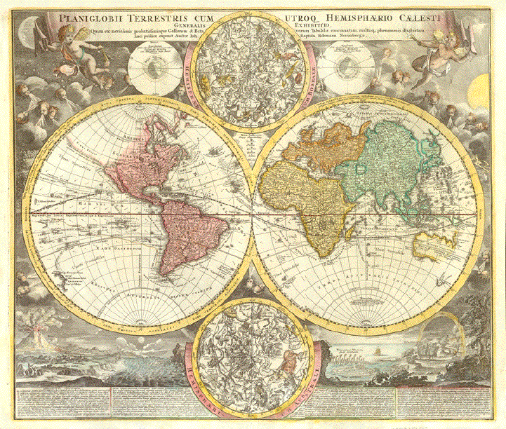
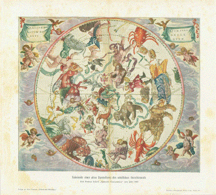
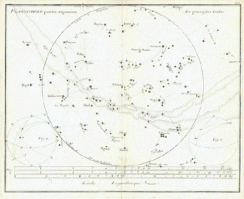
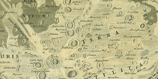
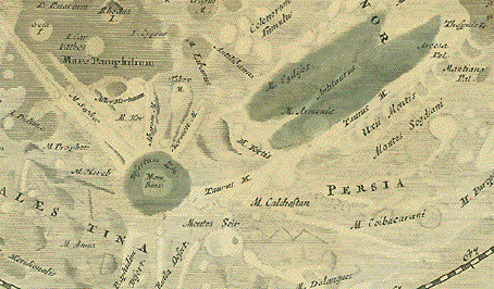
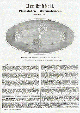
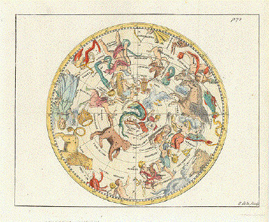
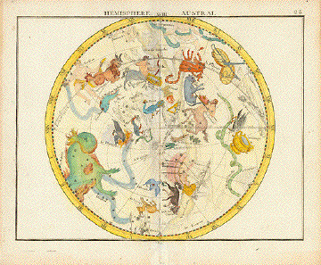
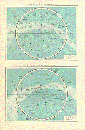
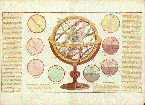
Terrestial and celestial spheres

Attractively hand-colored map. Zodiac globe in center and several  detailed globes surrounding it.

This map gives us no author. But it is decidedly French. Most likely published ca. 1760/80 in Paris in the style George Louis Le Rouge (1712-1780) published his celestial atlas. This map, however, is much larger (see measurements below). It bears the N° 1, suggesting that it was one of several in a series. And  two venders addresses suggest, that this map was individually sold in two book shops in the Quartier Latin of Paris.

Legend in the French language flanking the images on left and right side.

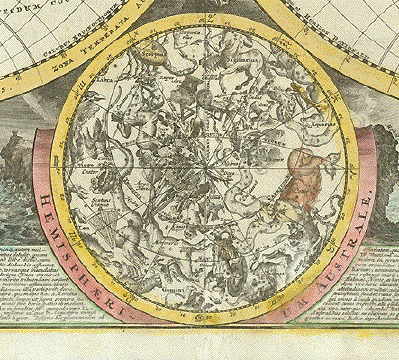
The titles of paragraphs beginning upper left:

"De la Sphere"

"L'Equateur"

"Des Tropiques"

"Le Zodiac"

"Les Cercles Polaires"

"L'Horson"

"Le Meridien"

Condition: Very good condition. Very attractive hand coloring. Some spotting in margins and minimal traces of age and use only in margins. Vertical centerfold. Tiny piece of lower right corner is missing.

32 x 55,5 cm (ca. 12.5 x 21.9")

$ 650,00

Order Nr. CELESTIAL251484


Star map of the northern Hemisphere

"Der Noerdliche Sternhimmel (Mitte des 19. Jahrhunderts. ( The northern sky as known in the middle of the 19th Century) Steel engraving by A. Stieler and D.C. Bruhns dated 1870. Printed in light green.

This celestial map is very interesting for its great detail in the center circle that reaches as far as the Equator. Around the outside of this circle are the various signs of Zodiac with light drawing of the figures.

The map is in very good condition except for a small repair on the centerfold in the lower margin. A few very light spots.

26.5 x 34.8 cm ( 10.4 x 13.7 ")

$ 150.00

Order Nr. CELESTIALMAP235794


"Sytema Mundi Tychonicum secundum celeberrimorum Astronomorum Tychonis de Brahe et Io. Baptistae Riccioli. S.J. Hypotheses consinnatum a Joh. Gabr. Doppelmajero Math. Prof. Pub. opera Ioh. Bapt. Homanni Norimbergae"

Copper etching by Johann Gabriel Doppelmayer (1677-1750)

Original hand coloring. Published by Homann Erben. Nuremberg, 1730

System of the sun, based on Tycho Brahe (1546-1601), one of Europe's foremost astronomers.

In the center Brahe's solar system surrounded by the 12 symbols of the zodiac.

And Apollo driving his horse-pulled chariot across the skies

Upper left corner: Solar system according to Brahe

Upper right corner: Solar system according to Giovanni Riccioli S.J.

Lower right corner: Egyptian solar system

Lower left corner: Solar system according to Giovanni Riccioli S.J.Shown differently

Map has several tears repaired by backings and parallel to the centerfold an additional vertical fold. There are some minor repairs in margins also. Repair on lower and upper cvenerfold.. But from the front this map looks much better than good.

48,5 x 58 cm (ca. 19 x 22.8")

Order Nr. ASTRONOMY 251762SOLD

Reverse side:


"Phaenomena Motuum Irregularium quos Planetae inferioresVenus et Mercurius ad annum Salutis MDCCX Directionibus Stationibus et Retrogradationibus suis et Terra spectandos praebent, exemplo singulorum Periodi pro Hypotheseos Copernic. firmamento Geometrice demonstrata A Ioh. Fabriele Doppelmajero Mathem. Prof. Publ. opera Ioh. Baptistae Homanni Noribergae."

Copper etching by Johann Gabriel Doppelmayer (1677-1750)

Original hand coloring. Published by Homann Erben. Nuremberg, 1730

In the center of the celestial chart we see the Sun as the focal point of our solar system. Fundamental basis for the chart are the orbits of Earth, Venus and Mercury as calculated for the year 1710 by Copernicus and projected transit of the planet Venus as it goes across the sun in the year 1761. - Our earth is pulled through space on clusters of clouds by a chariot with six horses. The wheel of the chariot, visible to the viewer, depicts the south pole of the earth. Above are Venus and Mercury also shown with their insignia on clouds

Extreme upper left corner was missing and has been attached. Tiny piece of upper right corner is missing. Margins all around are narrow and show traces of age and use. The original hand coloring is attractive. Centerfold has been smoothed.

48,5 x 57,5 cm (ca. 19 x 22.6")

Order Nr.ASTRONOMY251942SOLD


Planet system of the sun - Planeten-System der Sonne

Planeten-System der Sonne

Steel engraving by A. Stieler dated 1871.

The map shows the planets of our solar system with special insets showing their sizes and paths around te sun. There are details of the rings of Saturn as well as the 24 hour positions of the sun and earth.

Map has a repair on the reverse side on the centerfold. Very minor signs of use and age.

32 x 34 cm ( 12.5 x 13.3 ")

$ 150.00

Order Nr. CELESTIAL236473


Celestial Map

Image: 14 x 16.5 cm ( 5.5 x 6.4 ")

Transparent Layover:

Celestial Map

"Faksimilie einer alten Darstellung des Ptolemaeischen Weltsystems"

Wood engraving printed in color after the original by Andreae Cellarii. Published 1900.
Attached to the map is a transparent layover with the names of the star formations.

Map and layover both have a vertical centerfold.

$ 40.00

Order Nr. CELESTIAL246860


No Title.

Celestial map shows many interesting aspects of the solar system such as the star constellations of
the north and south hemisphere as well as an image of the moon and the antipodes of the earth.

This map was published in the Geographischen Institut in Hildburghausen ca 1890.

Vertical centerfold to fir original book size. Imprint is light.

21 x 27 cm ( 8.2 x 10.8 ")

Order Nr. CELESTIAL248982 SOLD


Gestirnte Himmel

"Der Gestirnte Himmel"

Lithograph ca 1875 showing the positions of the stars on the northern sky. The names of the various
constellations are in German.

Diamater: 33 cm ( 12.9 ")

$ 120.00

Order Nr. CELESTIAL249056


"Sonnensystem: Innere-Planetengruppe"

Lithograph by L. Ravenstein, printed in color, 1890. Vertical centerfold.

Extra page of text ( in German ) with interesting information and statistics.

15.5 x 22 cm ( 6.1 x 8.6 ")

$ 60.00

Order Nr. CELESTIAL250635


"Planeten System der Sonne"

Extremely interesting celestial map showing various aspects of the solar system. The large circle has the signs of Zodiac
and also specific comets and dates. In the lowe right are details and dates of orbit of the Earth, Venus ans Mercury.
In the lower left is information about the moon.
Map is dated 1873.

Map has a vertical centerfold.

32 x 34 cm ( 12.5 x 13.3 ")

$ 145.00

Order Nr. CELESTIAL248879


"Das Planeten System"

This lithograph shows the path of some of the planets in 88 days.Published ca 1875.

This lithograph has several creases in the image and upper margin.

31 x 34.5 cm ( 12.2 x 13.5 ")

$ 90.00

Order Nr. CELESTIAL240057


"Planiglobii Terrestris cum Utroq Hemisphaerio Caelesti Generalis Exhibitio, ......."

Copper engraving map by Johann Baptist Homann, published in Nuermberg 1720.
Hand coloring.

In the upper corners are decorative putti blowing the breath of life into the world globes.
In the lower left is the eruption of Mount Etna. In the lower right is a rainbow and water
rising in little towers in Norway. Very detailed information about these and other
natural phenomena.

The vertical centerfold has been professionaly flattened so as to be invisible
on the front side Small repair on lower centerfold. Minor creasing in left margin.

Map image: 48 x 56 cm ( 18.8 x 22 ")

Order Nr. WORLD251512SOLD


Image: 22 x 26 cm ( 8.5 x 10.2")

Transparent Layover attached to map:

Celestial Map

"Faksimilie einer alten Darstellung des nördlichen Sternhimmels"

Wood engraving printed in color after the original by Andreae Cellarii, Published 1900.
Attached to the map is a transparent layover with the names of the star formations.

Map and layover both have a vertical centerfold.
Some light scattered spotting in margins. Very light browning on centerfold.
The transparent layover has some creasing and light natural age toning.

Image: 22 x 26 cm ( 8.6 x 10.2")

$ 55.00

Order Nr. CELESTIAL254483


"Planisphere pour les Alignements des principales Etoiles"

Copper engraving by Jean Nicolas Fortin ( 1750-1831 ) after J. Flamsteed ( 1646 - 1719 ).
Published 1776 in Paris.

Map of the stars from "Atlas Celeste de Flamsteed"

One repair on the lower centerfold and another in the lower right of image.

19 x 24 cm ( 7.4 x 9.4 ")

$ 130.00

Order Nr. CELESTIALMAP248628


Souther star map - Der Suedliche Sternhimmel (Mitte des 19. Jahrhunderts.

"Der Suedliche Sternhimmel (Mitte des 19. Jahrhunderts.) ( The Southern sky as known in the middle of the 19th Century) Steel engraving by J. Baer and D.C. Bruhns dated 1870. Printed in light bluish green.

In the center of the map is the South Pole. The outer circle of the concentric circles is the Equator.Around the outside of this circle are the various signs of Zodiac with light drawing of the figures.

The map is in very good condition. A few very light spots in margins.

29.5 x 36.2 cm ( 11.6 x 14.2 ")

$ 150.00

Order Nr. CELESTIALMAP235869


"Tabula Selenographica in qua Lunarium Macularum exacta Descriptio secundum
Nomenclaturam Praestissimorum Astronomorum tam Hevelii quam Riccioli...

Copper engraving map by Johann Baptist Homann in Nuerenberg, ca 1707 after
Johann Gabriel Doppelmayer ( 1671-1750).

The two maps showng the surface of the moon are from models by Johannes Hevelius
and Giovanni Battista Riccioli using their nomenclature.

Johannes Hevelius was the first to publish a treatise entirely about the moon. He founded the science
of selenography - the science of the moon. It is named after Selene, the godess of the moon.

This map has attractive hand coloring. Small repair on lower centerfold.
Tiny piece of lower right margin has been added. A few minor signs of age and use.

48.5 x 57 cm ( 19 x 22.4 ")

$ 2400.00

Order Nr. MOON251485


Verteilung der Nebelflecke und Sternhaufen ueber die suedliche Himmelshaelfte

"Verteilung der Nebelflecke und Sternhaufen ueber die suedliche Himmelshaelfte". Wood engraving from Biliographisches Institut in Leipzig, ca 1875. Printed in color.

Light browning on margin edges. Centerfold.

Diameter of circle: 19 cm ( 7.4 ")
Page size: 24 x 29.7 cm ( 9.4 x 11.6 ")

$ 45.00

Order Nr. CELESTIALMAP2366


"Verteilung der Nebelflecke und Sternhaufen ueber die noerdliche Himmelshaelfte". Wood engraving from Biliographisches Institut in Leipzig, ca 1875. Printed in color.

Light browning on margin edges. Centerfold.

Diameter of circle: 19 cm ( 7.4 ")
Page size: 24 x 29.7 cm ( 9.4 x 11.6 ")

$ 45.00

Order Nr. CELESTIAL2367


"

"Mouvement et Positions de Mars pendant l'annee 1868"
"Positions de Jupiter et Saturne pendant l'annee 1868"

Wood engravings published 1870. On the reverse side is a diagram of the Planet Uranus in 1868.

24 x 15 cm ( 9.4 x 5.9 ")

$ 45.00

Order Nr. CELESTIAL249116


"Der Erdball"
"Die Jaehrliche Bewegung der Erde um die Sonne
von einem Punkte betrachtet, der nahe an der Ebene der Erdbahn liegt"

Image shows the path of the earth around the sun from a fixed point. Interesting article ( in German )
about the solar system that continues on the reverse side. Published ca 1885.

Page size: 30 x 20 cm ( 11.8 x 7.8 ")

$ 55.00

Order Nr. CELESTIAL249109


No Title.

Very lively illustrated celestial map. Copper engraving by B. Cole. Published 1755.
The names of the star formations are in Latin. Atrractive hand coloring.

Two vertical folds to fit original book size.

Diameter: 16.5 cm ( 6.4 ")
Page size: 20.5 x 23.5 cm ( 8 x 9.2 ")

Order Nr. CELESTIAL245246 SOLD


Hemisphere XVIII Austral

"Hemisphere XVIII Austral"

Type of print: Copper etching

Engraver / Artist: Anonymous

Color: Hand coloring

Publisher: John Flamsteed (1646-1719)

Published: Atlas Celeste (Plate 23)

Where / when: London,1753

View of southern sky star formations

Image: 17,5 x 22.4 cm (ca. 6.9 x 8.6")

Page size: 17,5 x 22,5 cm (ca. 8.5 x 8.9")

The vertical centerfold has been reinforced. Light browning of margin edges.
Repair in lower margin on centerfold. Overall light age toning.

Order Nr.CELESTIALMAP238835 SOLD


Upper image: " Noerdlicher Sternhimmel"
Lower image: "Suedlicher Sternhimmel"

Two detailed images of the northern and southern sta constellations published 1899.
The names of the stars are in Latin and German.

Page size: 41 x 26 cm ( 16.3 x 10.2")

Order Nr. CELESTIAL248843SOLD


Antique Astronomy Prints

Maps of the World

PRINTS OF THE ENTIRE WORLD: Antique town and city views.

BOTANICAL PRINTS

INTERIOR DECORATION

Ordering and Payment

E-mail

Terms of Sale - Lieferbedingungen

Home Page

Impressum

Datenschutz

© Rainer Rauhut