Maps Showing Lebanon
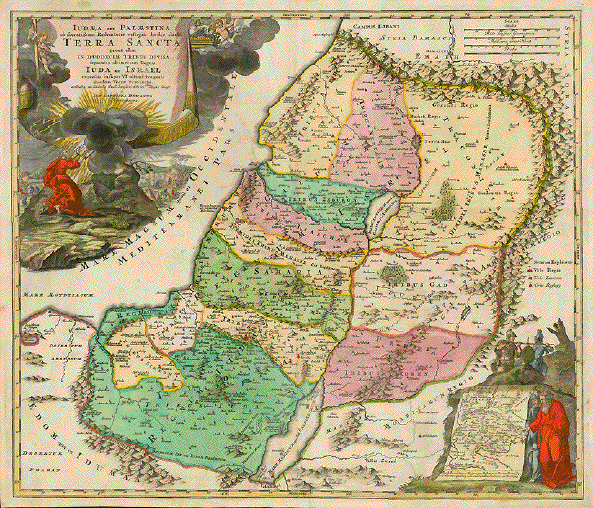
ãIudaea seu Palestina ob sacratissima Redemtoris vestigia hodie dicta Terra Sancta prout olim in duodecim Tribus divisa separatis ab invicem Regnis Iuda et Israel expressi insuper VI ultimi temporis ejusdem Terrae Provinciis..." Palestine or Israel , divided in the 12 territories of tribes of Israel. The baroque cartouche shows Mose receiving the Ten Commandments. Lower right inset: Mose and the High Priest pointing at map showing the paths the Children of Israel took after leavin Egypt. Above the little inset the two slaves carrying the heavy weight of the cluser of grapes. Copper etching. Fine original hand-coloring! Published by Johann Baptist Homann. Nuremberg, 1723. One repaired tear. Minor spotting and signs of age and use. Crease in lower left area. Strong paper. $ 550.00 Order Nr. HOLYLAND 236074 |
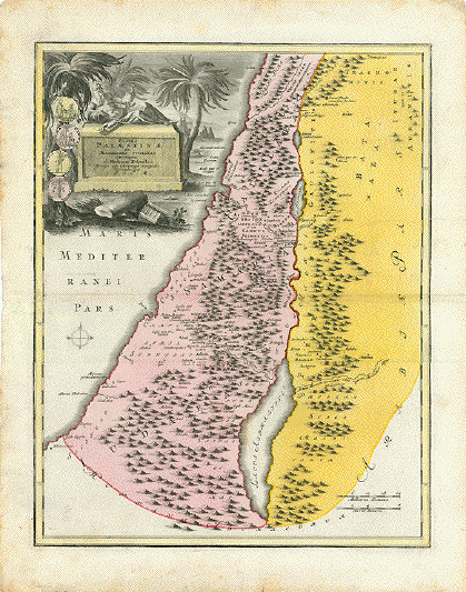
"Facies Palaestinae ex Monumentis veteribus descripto ab Hadriano RelandoÉ" Historic map showing what is nowadays Israel (Palestine) including Lebanon, Palestine, Gaza, the West Bank, Jordan, and parts of Syria. There are some coins and medals next to title cartouche. Type of print. Copper etching Color: Original hand coloring Author: Samuel Faber (1657-1716) Publisher: Christoph Weigel (1654-1725) Published: Nuremberg, 1720 Edition: Weigel reissued "Atlas ScholastichodoeporicusÉ" which Faber originally published in 1716. Condition: Beautifully bright original hand coloring. Reenforcement and repairs along centerfold. Wide margins spotty and a bit wrinkly. Traces of age and use. In general: Good. 40 x 32 cm (ca. 15.7 x 12.6") $ 160.00 Order Nr. NEAREASTMAP239219 |
ãReise Der Kinder Israel aus Egypten in das gelobte Land Canaan" Journey of the Israelites to the Promised Land Map shows diverse routes of Israelites from Egypt into the Promised Land Type of print: Copper etching Color: Hand-coloring. Author: Georg Walch Published: In a Lutheran German Bible Dated: 1640. Rare. Measurements: 33,3 x 46,5 cm (ca. 13.1 x 18.3") Condition: Map was a fold-out map. It has several, partially reenforced vertical and horizontal folds in order to fit smaller book size. Very pleasant hand-coloring. In general: Good condition. $ 780.00 Order Nr. HOLYLAND236073 |
Het Beloofde Landt Canaan door wandelt van onsen Salichmaecker Iesu Christo neffens syne Apostelen. Copper engraving by Nicolaes Visscher in modern (very good) coloring. Amsterdam 1659. From the "Hl. Scripture" published by same. Verso: text in Dutch. A description of the Jewish land. The northwest oriented map shows all of the Holy Land. There is a lavishly ornate Christian title cartouche flanked by two images and a fisherman each to either side at the bottom of the map. The images from left to right: Birth of Christ, Resurrection, Christ's Ascension, First Pentecost (The Holy Spirit fills the Apostles). Two cartouches, each held by three puttos, give descriptions and mileage. The Mediterranean Sea has several vessels, among them St. Paul's departure from the Holy Land. This attractive and rather rare map has an original loss of less than a millimeter along the centerfold, a repaired tear in the lower right reaching about two cm into the image (hardly visible from the front) and usual side folds to fit the book size. Lower right and left corners have minimal margin loss. A general patina of browning. Condition in general: definately Good. 31.5 x 47.2cm (12.4 x 18.6") $1250.00 Order Nr. HOLYLAND 1891 |
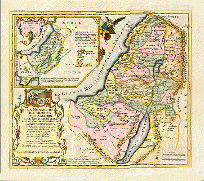
"La Monarchie des Hebreux sous Salomon, ou le Roiaume d'Israel distingué en Douze Prefectures ou Goverments....". Copper etching by Pierre Moulard Sanson in very good recent coloring. Paris, 1712. This map shows Israel during the reign of King Salomon. The inset in the upper left corner, held by an angel with a cornucopia, shows the position of Salomon's Kingdom in the Near East. A genre scene decorates the title cartouche in the lower left corner. Condition: Near Very good. Vertical centerfold. 34.9 x 40 cm (13.7 x 15.7 ") $ 880.00 Order Nr. HOLYLAND235597 |
"Descrition Geographique de la Terre Promise, Terre des Hebreux, et des Israelites Partagée selon l'Ordre de Dieu, aux Douze Tribus Descendantes des Douze Fils de Jacob". Copper etching by Pierre Moulard Sanson in outstanding recent coloring. Paris, 1712. In the decorative baroque cartouche in the upper left corner is the description of this map given in the title. It shows the land Israel with the locations of the 12 tribes. On the right an extremely decorative figurative border decoration with two Biblical scenes and a mileage chart at the bottom. The upper part shows a grape-harvesting scene where two harvesters carry a grapevine loaded with grapes. Condition: Near Very Good! Vertical centerfold that is hardly visible. 35.4 x 39.8 cm ( 13.9 x 15.7 ") $ 920.00 Order Nr. HOLYLAND235598 |
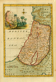
" Map of Canaan Divided among the Twelve Tribes." Copper engraving ca 1750. Anonymous. Hand coloring. Map shows the regions of the twelve tribes of Canaan (the early name for Palestina). The map extends from the Eygptian desert and Gaza in the south to Laodicea in the north. In the far right green area is the land of the Ishmaelites and Ammonites. Map has overall age toning. The outer margin edges are browned. Some light spots and image and scattered spotting in margins. Tiny hole in lower right margin corner. 29.5 x 20 cm ( 11.6 x 7.8 ") $ 180.00 Order Nr. HOLYLAND1920 |
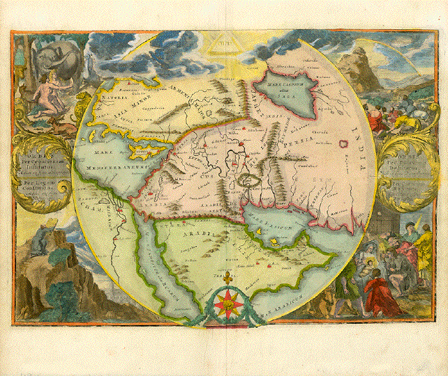
"Orbis Per Creationem Institutus" "Orbis Per Diluviun Definitutus" Copper etching by Roman de Hoghe (de Hooge) with very attractive hand coloring. Amsterdam 1693. Not published in an atlas! Rare! This circular map centers on the Middle East. Geographically it shows the Holy Land, Syria, Jordania, Palestine, Felix Arabia, Yemen, The Golf Arab Emirates, Egypt, Turkey, Cyprus, Irak, Iran, and parts of Pakistan. The corners show biblical scenes clockwise from lower left: "Per Legem Constitutus" Moses receives the Ten Commandments. Upper left: "Orbis per creationem institutus" Adam and Eve amidst animals. Upper right: Orbis per Diluvium destitutus" Mount Ararat with Noah's Arc on top and people having survived the Deluge. Lower right: "Per Christum Restitutus". Christ is born in Bethlehem. Generally well preserved clean map. Right side a bit fuzzy. No print on back. Margins have a few minor spots. Some traces of age and use. Two insignificant creases alongside centerfold in lower margin. Overall appearance: Almost Very Good. 32.4 x 45.9 cm (12.7 x 18 ") $ 1500.00 Order Nr.MIDDLEEAST238989 |
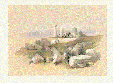
Tyre. - "Ruins called Om El Hamed near Tyre" Hand-colored lithograph from ãEgypt and Nubia" Published in London 1849 and , ãThe Near East and the Holy Land" by David Roberts (1796 - 1864). Published in London 1842 - 1849 No text. Reverse side has unrelated text print. Some minor traces of age and use. 24.2 x 34 cm (9.5 x 13.4") $ 300.00 Order Nr. DAVIDROBERTS235849 |
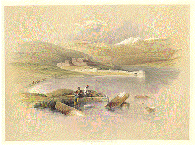
"Town of Tiberius, looking towards Lebanon" Hand-colored lithograph from ãEgypt and Nubia" Published in London 1849 and , ãThe Near East and the Holy Land" by David Roberts (1796 - 1864). Published in London 1842 - 1849 Upper margin corners are rounded. Very light smudging in upper margin. 24.8 x 33.9 cm ( 9.7 x 13.3 ") $ 480.00 Order Nr. DAVIDROBERTS4724 |
Antique Prints of the Holy Land and Near East
© Rainer Rauhut