ANTIQUE MAPS OF AUSTRIA

Enjoy looking at this selection of fine Austrian maps. Please ask us if you are looking for a special map for your collection.

Ordering and payment.

Old maps show normal signs of age and use. Special faults are described.

Unsere Oesterreich Abteilung ist um ein Vielfaches grösser als hier erscheint.

Lieferbedingungen

Sale! Discount!

30% Discount on All maps with an AUSTRIA number on this page!

Take 30% off the listed price. !

We accept reasonable offers.

"Herzogthum Kaernthen und Krain, 1852." Steel etching from "Neuster Zeitungs Atlas. Alter und Neuer Erdkunde" by J. Meyer, ca 1855. Original outline coloring.

In the upper left of this detailed map is Lienz and the Pasterner Kogel. In the upper right is Obdach, St. Leonard and Reichenfels. In the center of the map is Radmansdorf and Goriach. In the lower left is the Bay of Triest with Caorle and Pirano. In the lower right is Altenmarkt and Karlstadt.

Some very minor spots in margins. Condition is otherwise Almost Very Good.

18.7 x 24.7 cm (7.3 x 9.7 ")

$ 50.00

Order Nr. AUSTRIAMAP1016


"Carinthia Ducatus distincta in Superiorem et Inferior............"

Decorative copper engraving map by Martin Seutter of Carinthia (Kaernten). In the upper left is a fine
view of the city of Klagenfurt. This map shows the towns and cities in great detail as well
as the topography of this beautiful region of Austria.

Published in Augsburg ca 1750

Original hand coloring. The map image is in very good condition. The margins
show a few signs of age and use. Small repaired tear on lower margin edge.

49 x 58 cm ( 19.2 x 22.8 ")

$ 480.00

Order Nr. AUSTRIAMAP252626


"Rhaetia, Vindelicia et Noricum"

Rare copper engraving map by Joshua Archer (1792-1863)
Published by the Society for Promoting Christian Knowledge in 1847.
Very attractive original hand coloring.
Historical names (Latin-Celtic) of places and peoples.
The upper outline of the map is the Danube River. On the upper right is Vienna.
In the lower left is Lake Como, In the lower right is Aquilea and a tiny bit of the Adriatic Sea.

Light natural age toning in margins, especiall right margin edge.

Map image: 9 x 14 cm ( 3.5 x 4.5")

$ 220.00

Order Nr. DEUTSCHLAND255190


No title. Retia, Vindelicia, Noricum, Istria, Pannonia Superior, Pannonia Inferior, Illyriseu, Lyburnia, Dalmatia.

Wood cut by Martin Waldseemueller after Claudio Ptolemy. : From ãClaudio Ptolemei...Geographiae opus novissima...MDXIII". Strasbourg, 1513. Very nice recent hand coloring.

This very early map in trapeze form shows the ancient regions named above. It reaches from Bregenz in Western Austria to the Macedonian border. Showing Svebia, Bavaria, Austria, Slowakia, Slowenia, Croatia, Bosnia, Herzegowina, Hungary and parts of Romania south to the Macedonian and Albanian border.

Map has pleasant light age toninhg. Uper and lower margins have been added. Some traces of age and use of minor importance.

Trapeze: 33.3 x 43.5 to 50.5 cm (13.1 x 17.1 to 19.9"). Page size 37 x 58.8 cm (14.6 x 23.1")

$ 3200.00

Order Nr. BALKAN MAP 1044


"Theil der Illyrischen Provinzen - Parties des Provinces Illyriennes"

Copper etching by A. Buerck

This map of South Carinthia (Austria) Hermagor, North East Italy (area around Tarvisio and Slowenia (Bovec / Fritsch / Plezzo) is a most detailed map of a corner in Europe, where three countries meet: Austria, Italy, Slowenia.

This map was published by Geographisches Institut in Weimar, Germany. Since it was printed in the year 1807, the borders between the three countries have been altered and adjusted.

. Single sheet. Right upper margin corner a bit bent.

Image: 32 x 41 cm (ca. 12.5 x 16.1")

$ 90.00 (Please see discount at top of this page. Here 30% = $  63.00).

Order Nr. SLOVENIA254762


"Salisburgensis iurisdictionis locorumque vicinorum vera descriptio, auctore Marco Secznagel Salisburgense" Copper engraving by Marco Secznagel for the "Theatrum orbis terrarum" by Abraham Ortelius, ca 1600. Original hand coloring.

The map is west oriented so that "north" is on the right side.In the upper right is part of the course of the Inn River and a bit lower the Salzach River. In the lower left is part of the Drau river. In the center of the map is Zell See. One half of backside is printed (in Latin) with text about Salzburg.

Map has a few light spots in margins -one larger spot in lower right margin corner. Tiny repaired hole on right border. a few hardly noticeable creases. Centerfold has been reiforced on reverse side and slightly visible in lower area on front side,

37.9 x 46.2 cm ( 14.9 x 18.1 ")

$1550.00

Order nr. AUSTRIAMAP1024


"Austriche-Hongrie"

Map printed partially in color ca 1890. On the reverse side is text
about the Austrian-Hungarian Empire. Map has light natural age toning.
One light spot in the Adriatic Sea.

Map image: 18 x 25 cm ( 7 x 9.8")

$ 35.00 minus 30% discount = $ 24.00

Order Nr. AUSTRIAMAP256144


"Die Oesterreichischen Alpenlaender"

Map image: 36 x 47 cm ( 14.1 x 18.5")

********

Reverse side:

Left map: "Ungarn"
Map image: 23 x 38 cm ( 9 x 14.9")

Right map: "Boehmen und Maehren"
23 x 36 cm ( 9 x 14.1")
There is a color key in the lower right corner of both maps showing
the political divisions at the time.

These maps were printed in color ca 1890 on both sides of strong paper.
There is a vertical centerfold in the Austrian map and on the reverse side between the two maps.

A few signs of age and use in the margins.

$ 80.00 minus 30% Discount = $ 56.00

Order Nr. AUSTRIAMAP255958


"Napoleonische Zeit I ")

Four maps show the various political changes in Europe that came as a result of the Napoleon Wars.

Published 1896. Horizontal centerfold.

29 x 22.5 cm ( 11.4 x 8.8 ")

$ 60.00

Order Nr. DEUTSCHLAND248721


"Napoleonische Zeit II: Deutschland im Jahre 1812"

This map shows Europe as it was in 1812 as a result of the Napoleon invasions.
In the upper left is an inset of Aspern, Essling and Wagram in 1809.
In the lower left is an inset of Egypt in 1798. In the lower right is Europe in 1812.

Map was published 1896. Vertical centerfold.

22.5 x 29 cm ( 8.8 x 11.4 ")

$ 60.00

Order Nr. DEUTSCHLAND248722


"Oesterreich-Ungarn"

Map published 1892 in Leipzig. Map extends as far south as Montenegro and Turkey.
In the north is Chemnitz and Prag. In the east is Bukowina. In the west is a bit of Switzerland.
Light natural age toning in margins. Vertical centerfold.

Image: 21 x 27 cm ( 8.2 x 10.6")

$ 40.00 minus 30% Discount = $ 28.00

Order Nr. HUNGARYMAP256457


ãCarinhtiae Ducatus, et Goritiae Palatinatus". ãHistriae Tabula". ãZarae et Sebenici Descriptio". Three maps on one page. Copper etchings. Good recent hand coloring. Published in Abraham Ortelius: ãTheatrum Orbis Terrarum" 1598.

Left half devoted to Carinthia in Austria. Right side divided to equal parts between the peninsula of Istria and the area of Zadar in Croatia. On half of the reverse side is text in Latin about the areas shown on the map.

Wide margins. General age toning. Margins partially spotty. Nice overall condition.

Page size: 45 x 56.5 cm (17.7 x 22.2").

$ 660.00

Order Nr. AUSTRIAMAP1035


"Oesterreichisch. Ungarische Monarchie"

Very detailed map of the Austrian Hungarian Monarchy dated 1872. In the lower right corner is

an inset of Vienna and the surrounding area. In the upper left is part of Saxony. In the center of the map is Budapest.

Railroad lines are shown. Some original yellow outline coloring.

Very clean map in good condition. Hardly visible vertical centerfold.

33 x 40 cm ( 12.9 x 15.7 ")

Order Nr. AUSTRIAMAP249249 SOLD


"Salisburgensis jurisdictionis locorumque vicinorum..."

Copper engraving map by Mathias Quad and Johann Bussemacher. 

Hand coloring. Published 1608. On the reverse side is text about the Diocese of Salzburg.

The map is west oriented. In the upper right is the Inn River. In the center is Zellsee. 

Vertical centerfold. Some spotting and light creasing in margins.
Overall light natural age toning.

Image size: 18 x 26 cm ( 7 x 10.2" )"

$160.00

Order Nr. AUSTRIAMAP250070


"Tirol und Vorarlberg"

In the upper left is part of Lake Constance. In the lower right is a detailed inset with Lake Garda"

Wood engraving printed in color 1895. Light age toning in margins. Vertical centerfold.

22 x 27 cm ( 8.6 x 10.6 ")

$ 25.00

Order Nr. AUSTRIAMAP246221


"Theil von Tyrol. Sect. 175 Partie du Tyrol". Copper engraving published in Weimar by the Georgraph. Institut, 1804.

Very detailed map with Innsbruck and Hall in the center. In the upper left are the Thor Spitz and part of the Imau River with Mittenwald a bit to the right. In the lower left is the Mutterberger See and the Schran Kogl. In the upper left is Rattenberg. In the lower right is the Ahorn Spitze and Dreng Spitze.

Map has very wide margins. some light fraying on margin edges as well as a few small repaired tears on margin edges. Minimal spots in margins.

31 x 41 cm ( 12.2 x 16.1 ")

$ 120.00

Order Nr. AUSTRIAMAP1020


"Theil von Krain. Parthie de la Carntole"

Copper engraving published in Weimar by the Georgraph. Institut, 1804.

For orientation Villach is in the upper left corner of this map.
Tulmino (Tolmin, Tolmein) in Slovenia is in the lower corner of the map.

In the lower right is Krainburg (Kranj) in Slovenia.
In the upper right is the Drau River, Moechling and St. Veit in Jauntal.

Map has very wide margins. some light fraying on margin edges as well as a few small repaired tears on margin edges.
Minimal signs of age and use in margins.

Map image: 31 x 40 cm ( 12,2 x 15.7")

$ 200.00

Order Nr. AUSTRIAMAP253820


"Kronland Tyrol. u. Vorarlberg und souveraines Fuerstenthum Liechtenstein." Lithograph vy H. Mueller for C. Flemming ca 1860. Some original hand outline coloring corresponging to the political regions listed in the lower right map key.

In the center of this very detailed topographical map is Meran. The map extends as far sout as Lago di Garda and as far north to Schongau and Weilheim in Oberbayern. In the upper right corner of the map is St. Gildgen and in the upper left corner is Ravenstein and Bodensee. In the lower left is a list of the highest mountains on the map.

Map has a few very light stains in margins and a small piece of lower left corner is mising. Light crease in upper left margins corner.

32 x 39.7 cm ( 12.5 x 15.6 ")

$ 55.00

Order Nr. AUSTRIAMAP1031


"Oesterreich Unter Der Enns"

Detailed map published 1892. In the center is St. Polten.
In the lower left is Rotteman and in the upper left is Budweis.

Light natural toning in margins. Vertical centerfold.

Map image: 20.5 x 26.5 cm ( 5.8 x 10.4")

$ 25.00 minus 30% Discount = $ 17.50

Order Nr. AUSTRIAMAP256483


"Oesterreich Ob Der Enns"

Detailed map published 1892. In the center is Grieskirch.
Light natural toning in margins. Vertical centerfold.

Map image: 20. x 26.5 cm ( 5.7 x 10.4")

$ 25.00 minus 30% Discount = $ 17.50

Order Nr. AUSTRIAMAP256456


"Le Tirol, Souz le nom duqel s'entendent Le Comté De Tirol; puis les Comtés de Bregentz, Feldkirk, Montfort, Pludentz, & Sujets; et les Evesches de Trente, et Brixen ein protection des Comtes de Tirol." Copper etching by Sanson d'Abbeuille, dated 1654. Fine, modern hand coloring.

This map shows the extension of Tirol in the middle of the 17th century. In the upper left is Lake Constance and in the upper right is Salzburg and the Salzach River. Above the title cartouche is San Daniele and Belluno. To the left of the cartouche is Vicenza. Lago di Garda is in the lower center area and Lago di Como in the lower left. Almost in the center is Meran with Innsbruck a bit further north.

Map has wide margins. Vertical centerfold. Hand-written ink numbers in upper corners. General condition is otherwise Almost Very Good.

35.5 x 46.2 cm ( 17.9 x 18.1 ")

$ 880.00

Order Nr. AUSTRIAMAP1015


"Nieder- und Ober- Oesterreich"

Wood engraving printed in color 1895. Vertical centerfold. Light age toning.

21 x 28 cm ( 8.2 x 11 ")

$ 30.00

Order Nr. AUSTRIAMAP247530


Austria Oesterreich Osterrike

Lithograph ca 1850.

In the center of the map is Salzburg. On the right side is Budapest and in the upper left corner is Frankfurt am Main. In the upper center is Chemnitz and in the south is the northern tip of the Adriatic Sea.

Map has two folds to fit book size.

17 x 21,6 cm (6.7 x 8.5 ")

$ 50.00

Order Nr. AUSTRIAMAP1037


"Physikalische Karte von Oesterreich - Ungarn"

Detailed map showing the topography of Austria and Hungary. Printed in color 1895.
Map has a vertical centerfold. Light browning in margin edges.

21.5 x 28 cm ( 8.4 x 11 ")

$ 25.00

Order Nr. AUSTRIAMAP247595


"Militaerdislokation in Oesterreich-Ungarn"

Map published 1895. Vertical centerfold.

21 x 27 cm ( 8.2 x 10.6 ")

Order Nr. AUSTRIAMAP248175SOLD


"Österreichische Crais, Chrf. u. Herzogt. Bayern ". Copper etching by Tobias Conrad Lotter ( (1717-1777) after Tobias Lobeck for the "Atlas Geographicus portabilis" (Pocket-size atlas) published 1760-1762. Original hand coloring.

Salzburg is almost excactly in the center of this map reaching as far south as Padua and Bescia. In the north is Bamberg and Prague.

In the upper left is Wertheim and Rotenberg. Lake Como is in the lower left and Croatia in the lower right. In the upper right corner is Schoenberg und Olmutz.

A few light creases in map image. Browning in right margin.

9.5 x 12.2 cm ( 3.7 x 4.8 ")

$ 280.00

Order Nr. DEUTSCHLANDMAP1334


"Salzburg"

Detailed map of the area to the south of Salzburg, located at the top of the map.
In the upper left is and inset of Salzburg and the area to the north.
In the lower part of the map is Kaernten. Published 1892.

Image: 13 x 21 cm ( 5.1 x 8.2")

$ 25.00 minus 30% Discount = $ 17,50

Order Nr. AUSTRIAMAP256484


"Erz-Herzogthum Oesterreich: Ob Der Enns 1838. Steel etching from "Neuster Zeitungs Atlas. Alter und Neuer Erdkunde" by J. Meyer, ca 1855. Original outline coloring.

The Wolgangsee is in the center of this very detailed map. At the top of the map is Schwarzenberg and Ulrichsberg. In the lower right is an inset with a detailed plan of Linz and surrounding area.

Map has a few light spots.

18.5 x 24.8 cm ( 7.2 x 9.7 ")

$ 70.00

Order Nr. AUSTRIAMAP1028


ãArchiducatus Austriae Superioris in suas Quadrantes Ditiones exacte divisi accuratissima Tabula"

Copper etching. Absolutely finest original hand coloring, even including title cartouche.

Published by Johann Baptist Homann

Where: Nuremberg. When: Ca. 1723

48 x 57 cm (ca. 18.9 x 22.4")

Condition: extra fine

Order Nr. AUSTRIAMAP238200 SOLD


"Confederation Germanique Royaume de Prusse Empire D'Autriche Royaume de Pologne"

Map shows the various divisions of Europe at the time.

Copper engraving by F. Delamarche dated 1828. Published in his atlas in 1832.
Original outline coloring.

Vertical centerfold. Small repairs in margins on centerfold. Light creasing on right side.

27.5 x 36 cm ( 10.8 x 14.1 ")

$ 45.00

Order Nr. EUROPEMAP242279


"Politische Uebersichtskarte von Oesterreich - Ungarn"

Interesting political map showing the political boundaries of the time. Printed in color 1895.
Map has vertical centerfold and light browning in margins.

21.5 x 28 cm ( 8.4 x 11 ")

$ 25.00

Order Nr. AUSTRIAMAP247594


"Goritiae, Karstii, Chaczeolae, Carnilae, Histriae, et Windorum Marchae Descript. " Copper etching after Wolfgang Lazius by Abraham Ortelius in very fine, modern, hand coloring. From the atlas "Theatrum Orbis Terrarum" by Abraham Ortelius. Published ca 1580.

Map is north oriented. On the left side is part of Carinthis is the upper left and abit lower is Goriza and then the Gulf of Trieste. The Istrian peninsula with the ancient names of its cities and towns points south into the Adriatic Sea. The islands in the lower right have their ancient names of Vegia, Arbi, Cigola and Osero. The lake shown is Lake Zirknitzer, the size much larger than it actually is. In the upper right is part of Styria

Margins are wide except the left margin is narrow as this map was on a page with the Rhaetia map. The map was not printed straight on the page. This is not disturbing by fine, antique maps. Small, repaired tear on lower margin edge. The image of the map is in very fine condition.

34 x 23 cm ( 13.3 x 9 ")

$550.00

Order Nr. CROATIAMAP2435


"Sued - Oestliches Deutschland nebst einem Theile des noerdlichen Italian"

Steel engraving by W. Alt, Berge and C. Jungmann after Herman Berghaus for Stieler. Dated 1871. Original hand outline coloring.

Interesting historical map extending as far north as part of Franconia and the Czech Republic. The path of the Danube is clearly visible and reaches as far as Pressburg on the right side. In the lower right is part of Istria and Croatia. In the lower left is Genoa (Genua), Alessandria, and Bologna. On the left side is a diagram showing the distances of various towns between Munich and Mantua. On the right side is a diagram showing the distances of many towns between Glocknitz and Trieste. Also shown on the map are railroad lines.

Map has light age toning. There is a repair on the lower part of the centerfold.

29 x 40.5 cm ( 11.4 x 15.9 ")

$ 85.00

Order Nr. ITALIAMAPPA238210


"Contea Principesca Del Titolo". Steel engraving from an Italian source ca 1850. Original hand outline coloring.

Map shows the area of Tyrol with Lake Constance in the Upper left. On the right side is Kitzbuehel and Lienz. At the bottom is Lake Garda with Verona and Peschiera.

Map has a few light scattered spots especially in the margins near margin edges. A few light creases. In the lower right margin corner is a printer's stamp. Light uneveness in the paper.

31.5 x 20 cm ( 12.4 x 7.8 ")

$ 185.00

Order Nr. ITALIAMAP1466


"Oesterreichisch Ungarische Monarchie"

Steel engraving edited by C. Vogel. Dated. 1870. Original hand coloring.

Very detailed map of the Austrian-Hungarian Empire. In the lower right is an inset showing Vienna and surrounding area.

Very clean image. Minor signs of age and use in margins.Small ink marks in lower margin. Small repair on centerfold in lower margin.

33.2 x 41.5 cm ( 13 x 16.3 ")

Order Nr. AUSTRIA237876SOLD


Deutschland im 17. Jahrhundert

"Deutschland im 17. Jahrhundert ( 1648 )"

Detailed map published 1896 of the political divisons of Germany in 1648.
In the lower left is an inset of Prag and the Weisser Berg. In the lower left are insets of Magdeburg,
Breitenfeld and Luetzen.

Small repair in lower margin on centerfold.

22 x 29 cm ( 8.6 x 11.4" )

$ 50.00

Order Nr. DEUTSCHLAND248719


Deutschland un Oberitalien im 15. Jahhundert ( 1477 )"

Map shows the political divisons as they were in 1477. In the upper left is an inset of "Wettische Lande".
In the upper right is a detailed inset of the "Kreiseinteilung" at this time.
In the lower right is a plan of Rome.

The map was published in 1896. Vertical centerfold.

22.5 x 29 cm ( 8.8 x 11.4 ")

$ 55,00

Order Nr. DEUTSCHLAND248717


"Steiermark, Kaernten, Krain." Lithograph by E. Serth for Tr. Bromme's Hand Atlas ca 1870. Partially printed in color with original hand outlining. Outline colors match with the key in the lower right corn showing the various regions.

Almost in the center of the map is Neumarkt in Krain. The lower pink area is Istrien (Croatia) with its many islands. In the upper right corner is Wiener Neustadt. Traunstein in Oberbayern is in the upper left corner.

Map has horizontal centerfold. Repair in left margin on centerfold. Two tiny repaired tears on lower margin edge.

37.5 x 28.5 cm ( 14.7 x 11.2 ")

$ 50.00

Order Nr. AUSTRIAMAP1032


Austria Hungary

"Karten zur Geschichte Oesterreich-Ungarns"

Map showing the history of Hungary and Austria from 1273-1795.
Map was published 1888. Vertical centerfold.

20 x 26 cm ( 7.8 x 10.2 ")

$ 40.00

Order Nr. HUNDARY248705


Herzogthum Steyermark". Steel etching by J. Graessl from "Neuster Zeitungs Atlas. Alter und Neuer Erdkunde" by J. Meyer, 1858. Original outline coloring.

Nice detailed map of Styria, especiall care detail of the mountains.

Map has pleasant age toning. Minor spotting in margins.

25.8 x 21.2 cm ( 10.1 x 8.3 ")

$ 50.00

Order nr. AUSTRIAMAP1036


Copper etching from: "Geographia" by Claudio Ptolemy. Originally edited and published by Willibald Pirckheimer. This edition, which comprises all 64 maps of the "B" edition, including the "New World", was published by Josephus Meletius 1562 in Venice.

This map shows Austria, southern Germany, the Balkans and Italy. In the north is the Danube river and the Carpathian mountains. In the upper left is a bit of the Rhine river. Text on backside gives historical data in Italian of Rhatien and Vindelicia.

Map has light browning and repairs along centerfold. General condition is otherwise Good.

17.7 x 24.2 cm ( 6.9 x 9.5 ")

$320.00

Order Nr. MEDITERRANEANMAP1345


"Salisburgensis jurisdictionis..." Copper etching in very good modern coloring. By Mrco Setznagel (originator) and
Johann Bussemacher (engraver). For the atlas "Fasciculus Geographicus" by Matthias Quad (1557-1613). Printed at Johann Bussemacher. Cologne, 1590. Verso: Text in German.

This attractive west-oriented map is really a map of "Salzburger Land" in Austria and "Berchtesgadener Land" in Bavaria. A Renaissance title cartouche, a mileage key and the two coats of arms for the shown areas along with drawn in forests, mountains and the network of rivers help make this map as beautiful as it is.

18 x 26.4 cm ( 7.1 x 10.4 ")

$ 570.00

Order Nr. AUSTRIAMAP1004


"Ethnographische Karte Oesterreich Ungarn"

Fine xylograph showing the regions of the various ethnic groups of Austria and Hungary.
Map published 1906. Vertical centerfold to fit original book size.

21 x 27 cm ( 8.2 x 10.6 ")

Order Nr. AUSTRIAMAP245261SOLD


"Linz". Wood engraving by Rigolot ca 1880. Backside is printed.

Detailed map showing the region between Linz and Enns. In the upper part of the map is Kaltsdorf.

9.7 x 10.8 cm ( 3.8 x 4.2 ")

$ 35.00

Order Nr. AUSTRIAMAP1021


"Principali Dignitate Comitatus Tirolis.." Copper etching by Christian Weigel the elder (1654-1725) in original
coloring. Nuremberg, ca. 1720.

The region of Tirol is the point of interest of this map. In the west are the Swiss Alps. In the northwest is Lake Constance and Bavaria in the north. Salzburg and Carinthia are to the east. In the lower right corner is part of the Adriatic Sea. Notice that the
lakes of northern Italy are also shown.

The lower margin has been added to the map and the upper margin has been strengthened. Two small repairs have been made
which are hardly noticeable. The overall condition is Near Good.

32.7 x 39.7 cm (12.9 x 15.6 ")

$ 455.00

Order Nr. AUSTRIAMAP1006


"Historische Karte von Oesterreich Ungarn"

Map shows the various political divisions using colors and dates showing the changes that took place
over the years from 1521 until after 1815. Published 1895.

Upper margin is narrow.

14.5 x 22 cm ( 5.7 x 8.6 ")

$ 20.00

Order Nr. AUSTRIA248174


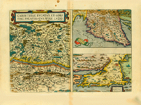
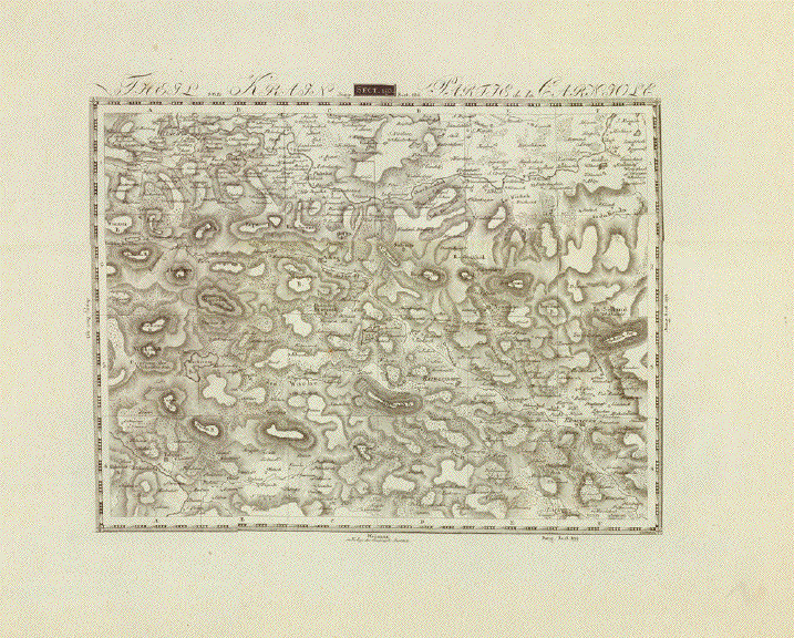
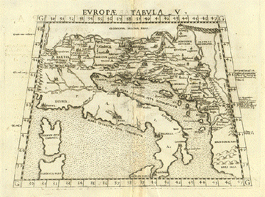
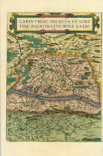
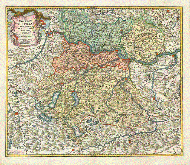
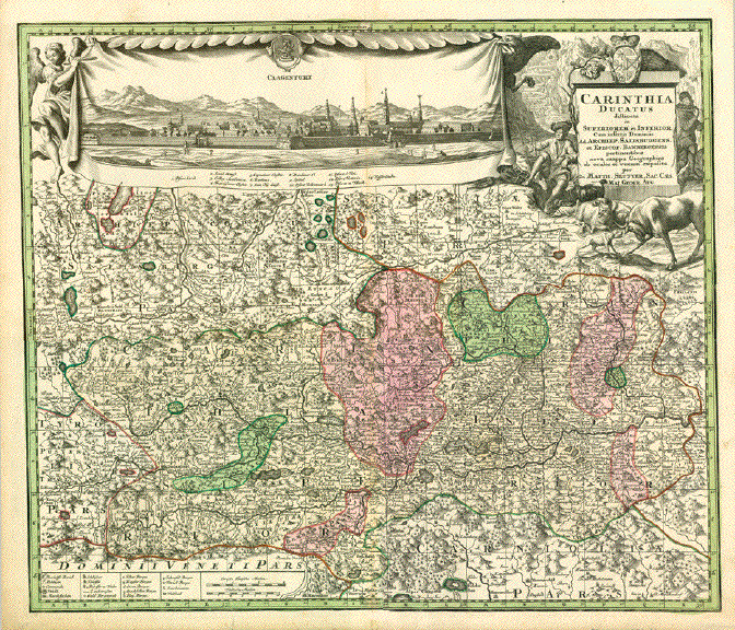
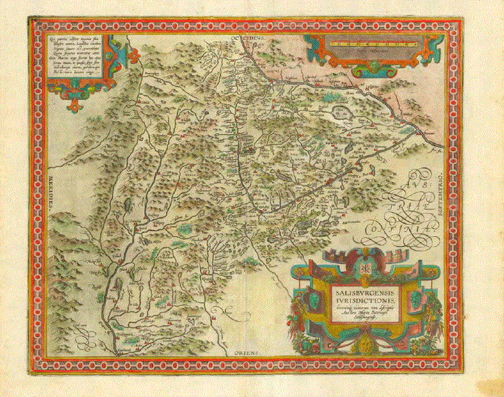
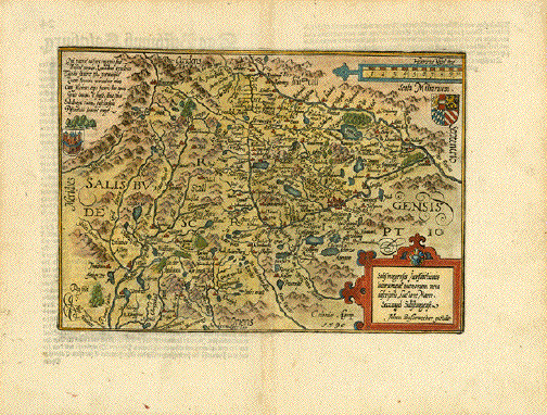
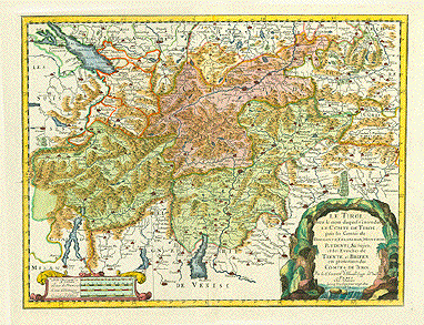
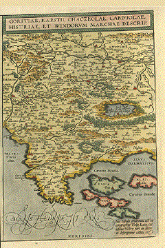
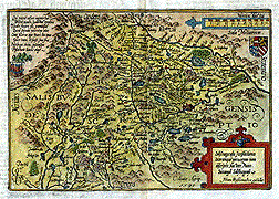
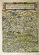
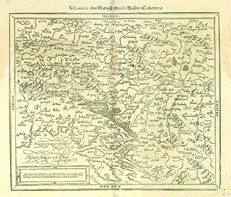
"Carinthiae Ducatus, et Goritiae Palatinatus, Wolf. Lazio"

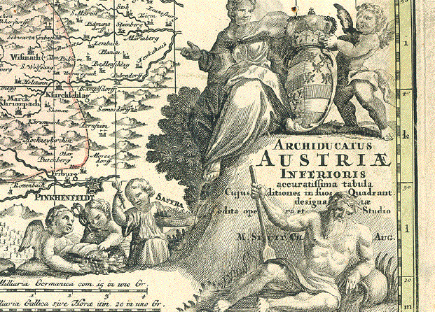
Hand-colored copper etching by Wolfgang Lazius (1514-1565)

Handkolorierte Kupferstichkarte von Wolfgang Lazius (1514-1565)

Published in "Theatrum Orbis Terrarum" by Abraham Ortelius

Antwerp, 1574

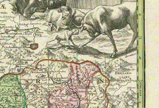
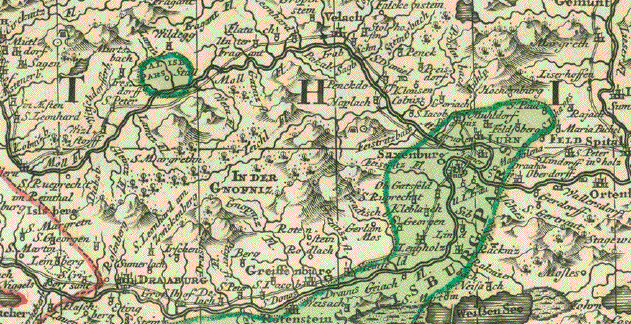
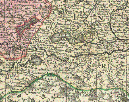
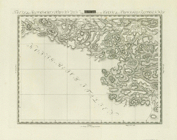
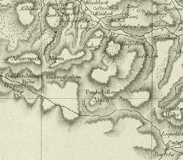
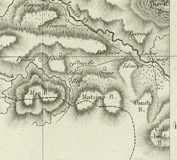
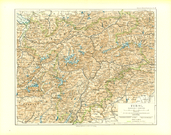
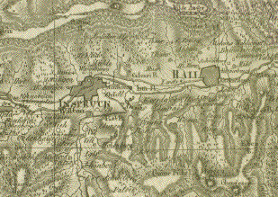
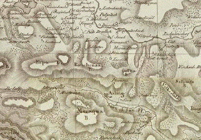
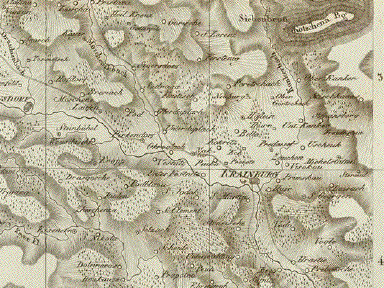
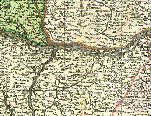
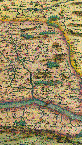
Area shown from Salzburg to Goerz and Gradisca. Drau river running clear across map from the river Moell to the river Lavant

We see Millstaetter See, Ossiacher See and Wörthersee in Carintha

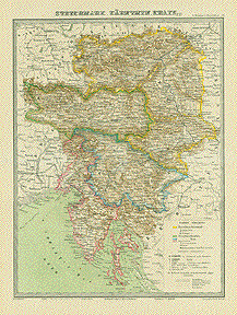
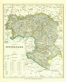
Die Karte zeigt Kaernten und Teile der Steiermark sowie Teile von Friaul.

Die Drau fliesst quer Durch die Karte von der Muendung der Moell bis zur Muendung der Lavant.

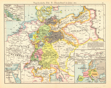
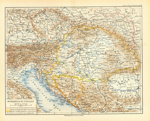
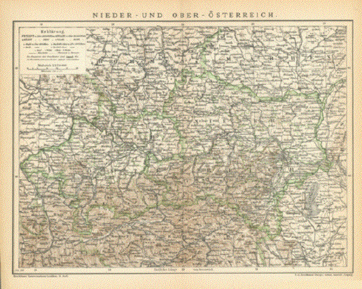
Dieses Gebiet war von 1500 bis 1918 Teil des Habsburger Reiches.

Nice hand coloring. Right margin narrow. Almost invisible repaired tear in upper margin.

Angenehmes Handkolorit. Rechts knappe Marge. Fast nicht erkennbarer reparierter Einriss in der oberen Marge.

33,2 x 24,3 cm (ca. 13 x 9.5")

$ 400.00

Order Nr. AUSTRIA252993


Carinthiae Ducatus, et Goritiae Palatinatus.
Copper engraving (modern coloring) by Wolfgang Lazius from the atlas "Theatrum Orbis Terrarum" by Abraham Ortelius. Antwerp, ca 1580.
A beautifully exaggerated river Drau partitions this map showing Carithia and the Friaul. Lakes and forest, mountains and a network of rivers and streams give the map a very attractive appearance.

Rest margin is narrow and underlaid.

33,3 x 24, 1cm (13,1 x 9,5")

$ 400.00

Order Nr. AUSTRIAMAP1001


"Archiducatus Austriae Inferioris accuratissima tabula...." Copper engraving by M. Seutter, ca 1740. Hand coloring.

Very detailed map with the course of the Danube in the upper middle area. On the left the Danube enters at Enns and Steyr and flows out on the right side at Presburg. In the upper left corner is Rudolfstadt in Bohemia. In the upper right is Landtshut and Goding on the Moravia River. In the lower left is Rottenman in Styria. In the lower right near the cherubs is Pinkenfeldt and Friburg. Decorative cartouche.

Map has some light browning in margins and light smudging in lower right margins and cartouche. Vertical centerfold.

49.5 x 58 cm ( 19.4 x 22.8)

$620.00

Order Nr. AUSTRIAMAP1026


ãSclavonia oder Windisch Marck / Bossen/ Crabaten / etc". Woodcut from the ãCosmographia" by Sebastian Muenster (1488 - 1552). Ca. 1550.

From Carinthia to Triest and from the Drau river to Oberwossen in Croatia.

General age toning, somewhat darker in upper left and right margins and along centerfOld. A black spot in paper. Print from reverse side (title of map in

German) is showing faintly. Browning in upper left and right margins.

31.5 x 36 cm (12.4 x 14.2")

$ 260.00

Order Nr. SLOVENIAMAP2419


"Nova Totius Germaniae Descriptio". Copper etching by Peter Bertius (1565-1629) for Philipp Cluver Philipp (1580 - 1623) , an early author of historic maps. His works were published long beyond his lifespan. The This map comes from a pocket size atlas (duodez): Philippi Cluverii. Introductionis in Universam Geographiam tam veterem quam novam Libri. Amsterdam, 1661. Originally colored.Centerfold. Size: ca.12 x 12,5 cm (ca.4.72 x 4.92"). Narrow margins all around, especially on right side. General toning. Minimal foxing.

This map of Central Europe focuses on Germany and the surrounding countries. The yellow - colored river to the left is the Rhine in its entire course. This map reaches far to the east with Koeningsberg in the northeast and as far south as Croatia.

$ 200.00

Order Nr. DEUTSCHLANDMAP1182


Ansichten von Österreich-Views of Austria

Alte Trachten von Österreich - Old Costumes of Austria

Maps of the World

EXCLUSIVE Prints and Maps Rare and exquisite decoration.

Ordering and payment.

E-mail

Terms of sale - Lieferbedingungen

Return to Home Page

Impressum

Datenschutz

© Rainer Rauhut