Antique Maps of Central America

View of selection of historical maps of Central America. If you are searching for a particualr map, please contact us.

Hablamos español.

Ordering and Payment

Lieferbedingungen

Sale! Discount!

30% Discount on All maps with a CENTRALAMERICAMAP number on this page!

Take 30% off the listed price. !

Visit us at the following sites:

https://lovelyantiqueprints.com

twitter.com/philographikon2

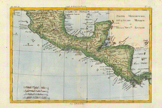
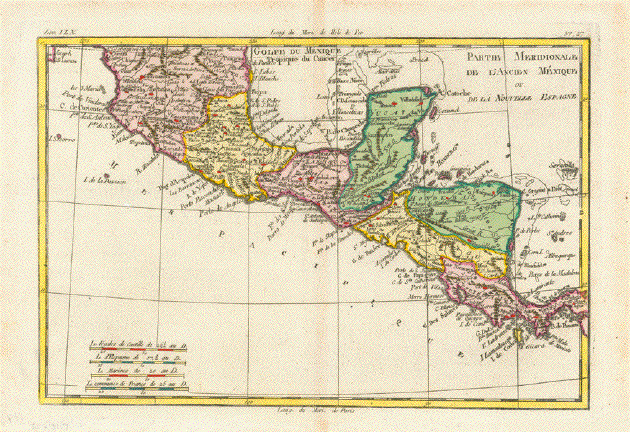
"Partie Merionale de L'Ancien Mexique ou de la Nouvelle Espagne". Copper etching by Rigobert Bonne (1729-1795) for "Atlas de toutes les parties connues du globe terrestre" by Guillaume Thomas Francois Raynal (1713-1796). Published 1780 in Geneva. Modern hand coloring.

This map shows the southern part of Mexico with the Tropic of Cancer in the north and reaching as far south as Colombia. In the upper left corner is a tiny piece of Baja California to be seen. Many of the small, surrounding islands are shown.

Except for uneven coloring along centerfold the map is in Almost Very Good condition.

21 x 31.9 cm ( 8.2 x 12.5 ")

$ 200.00

Order Nr. MEXICOMAP2803


Nord America Central Amerika

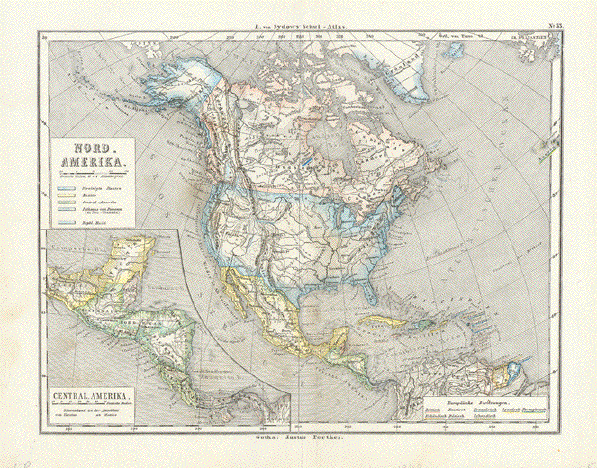
"Nord Amerika. Central Amerika"

Steel engraving ca 1860. Original hand coloring. Published in Gotha by Justus Perthes.

Small repair on lower margin edge on centerfold. Fine, clean image.

19.5 x 25 cm ( 7.6 x 9.8 ")

$ 65.00

Order Nr. NORTHAMERICA246143


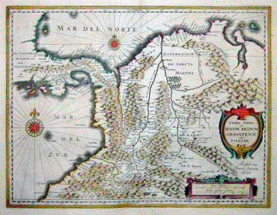
"Terra Firma et Novum Regnum Granatense et Popayan". Copper etching by Wilhelm Janzoon, published in Amsterdam ca 1640. Original hand coloring.

This map shows Panama and the northwest part of South America as far south as the Equator. In the upper right is Lake Maracaibo and the Golf of Venezuela. Notice the windroses in the Carribean and Pacific Ocean. Verso: Text in German.

Map has light creasing near vertical centerfold.. Margins have light spotting and show minor signs of age and use. In the upper margin corners are very light water stains. Wide margins.

37.5 x 49 cm ( 14.8 x 19.2 ")

$ 770.00

Order Nr. CENTRALAMERICA2003


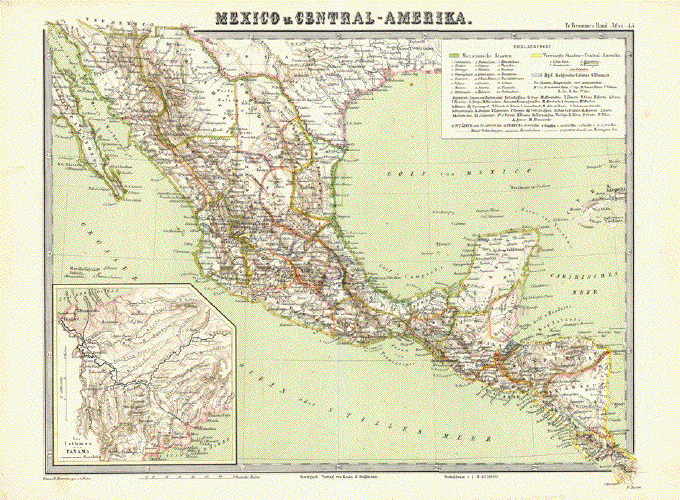
"Mexico u. Central-Amerika". Lithograph by C. Baur for Traugott Bromme ca 1865. Printed in color.

Very detailed and accurate map of Mexico and Central America. In the lower left is an inset of the Isthmus of Panama.

Map has vertical centerfold. A few minor scattered spots, mostly in margins.

29 x 38 cm ( 11.4 x 14.9 ")

$ 85.00

Order Nr. MEXICOMAP2808


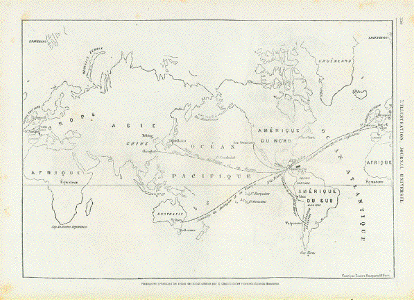
"Planisphere presentant les outes de transit offertes par le Chemin de fer interoceanique de Honduras"

Wood engraving by Kautz after Bonparte in Paris 1869. Interesting map showing
planned shipping routes of the ralroad company of Honduras.

On the reverse side are unrelated images. Hardly visible vertical centerfold.

Map image: 22 x 32 cm ( 8.6 x 12.5")

$ 65.00

Order Nr. CENTRALAMERICAMAP355047


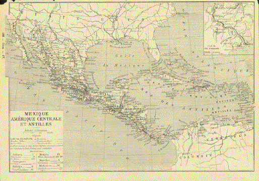
"Mexique Amerique Centrale et Antilles"

Detailed zincograph map of Mexico, Central America and the Antilles Islands.
Publisched ca 1890. In the upper right corner is an inset showing the Panama Canal.
The map legend in the lower right gives abbreviations and information.

Map has overall light natural age toning. On the reverse side is text about Mexico.

No upper margin. Tiny pieces of upper corner are missing.

Image: 18 x 25.5 cm ( 7 x 10")

$ 55.00 minus 30% Discount = $ 38.50.

Order Nr. CENTRALAMERICAMAP255369


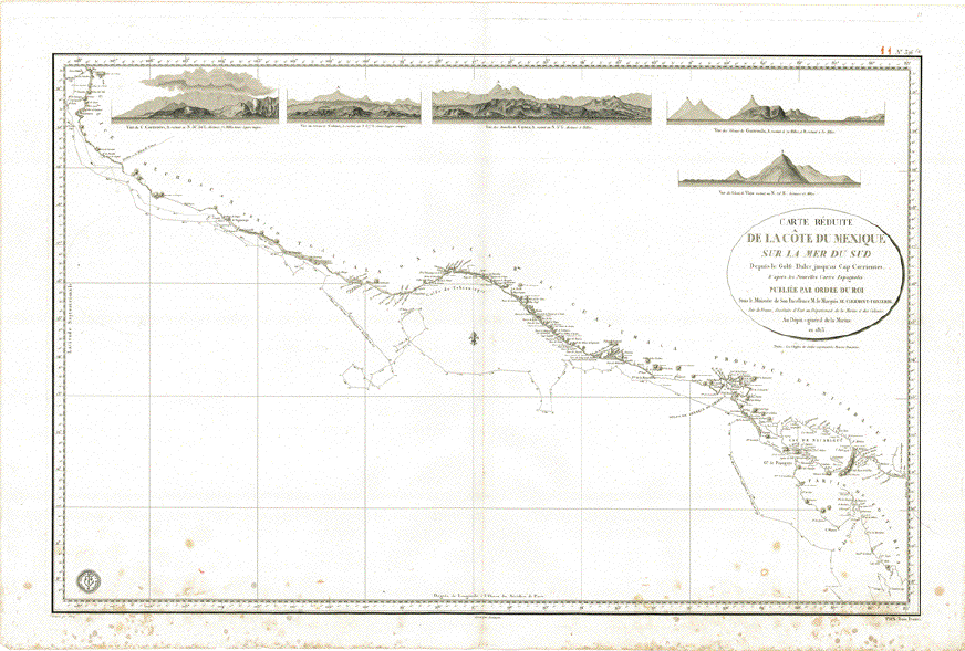
"Carte Reduite de la Cote du Mexique sur la Mer du Sud Depuis le Golfe Dulce jusque'au Cap CorrientesÉ"

Copper etching by Vicq in the name of the French King and the Department of the French Navy. It is dated 1823.

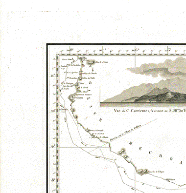
Across the top of this map we find (from left to right) profile views of Cap Corrientes, Colima (Vulcano), Mamelles de Coyuca, vulcanos in Guatemala and of the vulcano Viejo.

Although titled as coastline of Mexico, this map runs from Golfo Dulce near the Panama border along the Costa Rican, Guatemalan and Mexican Pacific coastline to San Blas, Nayarit. In other words: Pacific coastlines of Costa Rica, Nicaragua, Honduras, El Salvador. Guatemala and Mexico up to San Blas, Nayarit.

The mapping of this coastline was executed by geographic scientists on two corvettes of the Spanish Armada during the year 1791: "Descubierta" and "Atrevida". This expedition was called "Malaspina Expedition" and took place under the command of Captains Alessandro Malaspina and Jose de Bustamente y Guerra during the years 1789-1794.

The expedition began in Cadiz and went to Montevideo, Falkland Islands, Santiago de Chile, Lima, Acapulco, Nootka, Alaska and then continued across the Pacific to Asia, Australia, New Zealand and back to Cadiz.

Map has some spotting in lower part and in the lower margin, but is basically very clean. Vertical centerfold.

57 x 88,5 cm (ca. 22.4 x 34.8")

$ 1300.00

Order Nr. MEXICOMAP248443


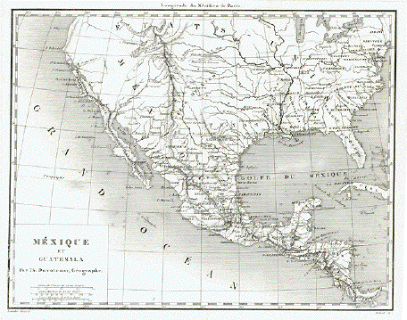
"Mexique et Guatemala"

Steel engraving by Delsol after Lemaitre for Th. Duvotenay, ca 1850.
Hardly visible original vertical folds.

17.7 x 23 cm ( 6.9 x 9 ")

$ 55.00

Order nr. NORTHAMERICA241544


"Patie Meridionale de L'Ancien Mexique ou de la Nouvelle Espagne"

Copper engraving by Rigobert Bonne ( 1727-1794 ) published ca 1775. Hand coloring.

At the tope of the map is the Tropic of Cancer. The map extends as far south as the Isthmus of Panama.
Map has some of the earlier names of topography and towns. In the lower left is a mileage chart.
In the upper left is the tip of Cabo San Lucas.

Map is in Good condition with very minor signs of age and use. Vertical centerfold.

21 x 31.7 cm ( 8.2 x 12.4 ")

$ 200.00

Order Nr. MEXICOMAP2801


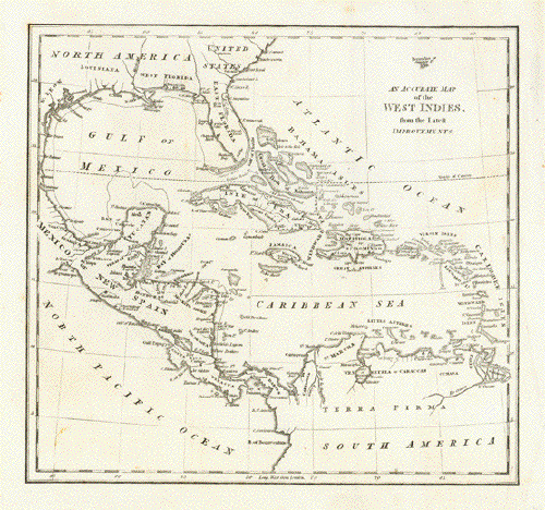
"An Accurate Map of the West Indies, from the latest improvements."

Copper engraving probably by R. Wilkenson in London ca 1795.

Above the title is Bermuda.

Crease in lower right margin corner. Small repair on upper and lower margin edge.
Clean image. One vertical fold to fit original atlas size.

22 x 23.8 cm ( 8.6 x 9.3 ")

$ 120.00

Order Nr. CARIBBEAN246146


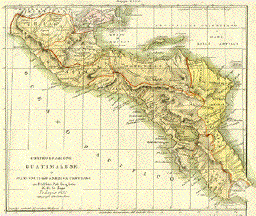
"Confederazione Guatimalese o Stati-Uniti nell'America-Centrale". Copper etching by A. Sage for "L'Atl. Stor. Poliz. Geog. Letter". Published in Venice, 1834. Original coloring.

This region of Central America was part of a Guatemalen confederation. In the north it reached to the Mexican border which was slightly different than it is today. In the south it reached to the border of Panama. Topographical features are shown in careful detail. Below the map is a description of the area in Italian with historical details.

Page has overall light toning and minimal spotting in margins. There is a repaired tear in the lower margin not affecting text. Condition is Almost Very Good.

Map Image shown: 19.8 x 23.3 cm ( 7.8 x 9.2 ")
Page size: 40 x 26.2 cm ( 15.7 x 10.3 ")

$ 200.00

Order Nr. CENTRALAMERICA2001SOLD


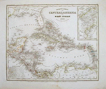
"Neuseste Karte von Centralamerica und West Indien 1843" Steel etching from "Neuster Zeitungs Atlas. Alter und Neuer Erdkunde" by J. Meyer, ca 1850. Some original outline coloring.

In the lower left is Central America. In the upper right is an inset of the Isthmus of Panama showing the area in fine detail.

Map image has a few scattered spots. Light browning and spotting in margins. Light creasing. Small repaired tear in left margin edge.

29.5 x 36 cm ( 11.6 x 14.1 ")

$ 340.00

Order Nr. CENTRALAMERICA2008


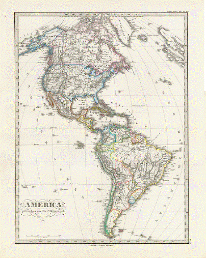
"America"

Steel engraving by W. Behrens after F. von Stuelpnagel. Dated 1871. Original outline coloring.

Fine map of the american Hemisphere. Many topographical details.

Map is in very good condition. Horizontal centerfold.

40.5 x 30.8 cm ( 15.9 x 12.1 ")

$ 85.00

Order Nr. SOUTHAMERICAMAP237980


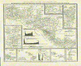
"Die Vulkanreihe von Guatemala, Die Landengen von Tehuantepec, Nicaragua and Panama, und die Central Vulkane der Suedsee. " (The volcanos of Guatemala, the Isthmus of Tehuantepec, Nicaragua and Panama, and the central volcanos of the South Seas). Steel etching from "Neuster Zeitungs Atlas. Alter und Neuer Erdkunde" by J. Meyer, ca 1850. Some original outline coloring.

Very interesting map with detailed insets. In the upper right are insets of Nicaragua and Panama. On the left is the Isthmus of Tehuantepec with fine topographic details. In the lower left corner is an inset of the Galapagos. At the bottom are the Hawaiian Islands, the Mendanas Archipelago, the Society Islands (Tahiti) and the Friends Island Group with such islands as Tufoa, Hapai and Late. Three graphs show the topographic situation of Panama, Costa rica and Guatemala.

Clean map in fine condition.

21.5 x 27.7 cm ( 8.4 x 10.9 ")

$ 140.00

Order Nr. CENTRALAMERICA2013


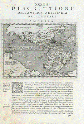
"Descrittione dell'America o dell'India occidentale" Plate XXXIIII (34)

Type of print: Copper etching

Artist: Girolamo Porro

After: Giovanni Lorenzo d'Anania

Published in: "Geografia cioe Descrittione Universale della Terra"

Publisher: Gio. Battista & Giorgio Galignani Fratelli

First published in: "Geographia" von Claudius Ptolemy

Edition: Italian edition

Editor: Giovanni Antonio Magini (1555-1617)

Text: Italian. Complete. 8 double pages with the following chapters:

The discovery of America

North America

Quivira ( a legendary area in North America, 1541 mentioned by Francisco Vazquez de Coronado

New Spain (Mexcio)

Nicaragua

Yucatan

Florida

Apalaches (Allegheny Mountains)

Norumbega (a legendary area in NE-USA)

New France (French territories in North America)

Labrador (Canada)

Estotilandia (Labrador, Greenland, Iceland)

Central America

Castella Aurea (Legendary area in Brazil where gold was found)

Peru

Chile

Brazil

Caribic Islands (2 articles)

Published in:Venice

Date:1598

Measurements:

Map size: Ca. 12,5 x 17 cm (ca. 4.9 x 6.7")

Page size: Ca. 28,5 x 19 cm (ca. 11.2 x 7.5")

Condition: Near perfect. Left margin narrow. Very minor traces of age.

$ 750.00

Order Nr. NORTHAMERICA236454


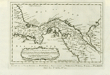
Carte de L'Isthme de Panama et des Provinces de Veragua, Terre Ferme et Darien.

Kaart van der Land-Engte van Paqnama eb Provintien van Veragua, Tierra firma en Darien.

Kopper engraving by Bellin dated 1754.

Detailed map of the Isthmus of Panama and the surrounding area.

Map has vertical folds to fit book size. Clean, strong image.

19.3 x 29.1 cm ( 7.5 x 11.4 ")

$ 275.00

Order Nr.CENTRALAMERICA2002 SOLD


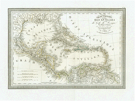
Carte Particuliere des Antilles du Golfe du Mexique avec l'sthme de Panama". Caribean Sea.
Copper etching by Giraldon-Bovinet after Vivien. Paris, 1825 (dated). Light original hand coloring.

Clean! Excellent condition

28 x 40 cm (11 x 15.7")

$ 525.00

Order Nr. CARIBBEAN2167


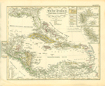
ãWest-Indien und Centro-America". Carribean Sea. Steel etching by Friedrich von Stuelpnagel. Gotha 1859.

Map includes all of Florida, parts of Alabama, Mississippi, Lousisiana. Three insets: Guadeloupe with Marie Galante; Havanna and harbor; Martzinique.

General age toning. Browning along margin edges.

30.3 x 39.7 (11.9 x 15.6")

$ 260..00

Order Nr. CARIBBEAN2166


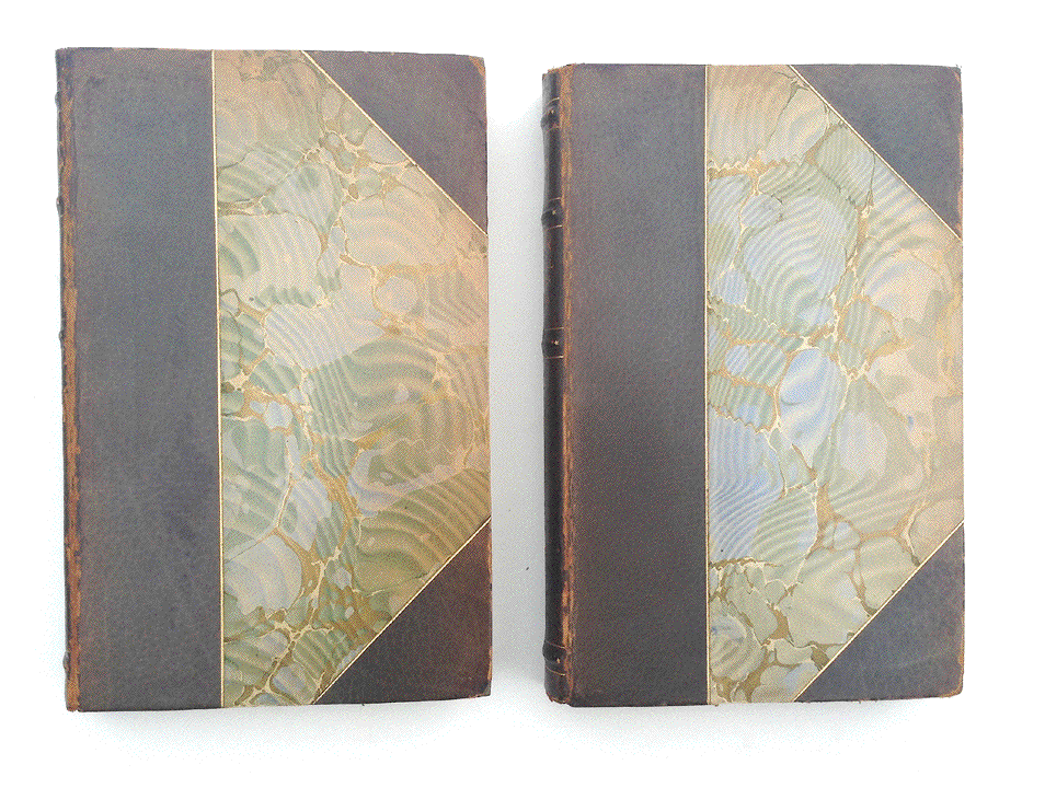
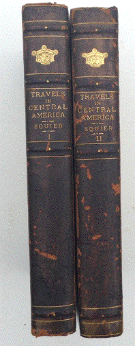
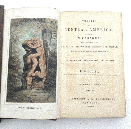
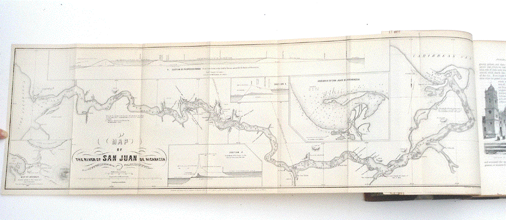
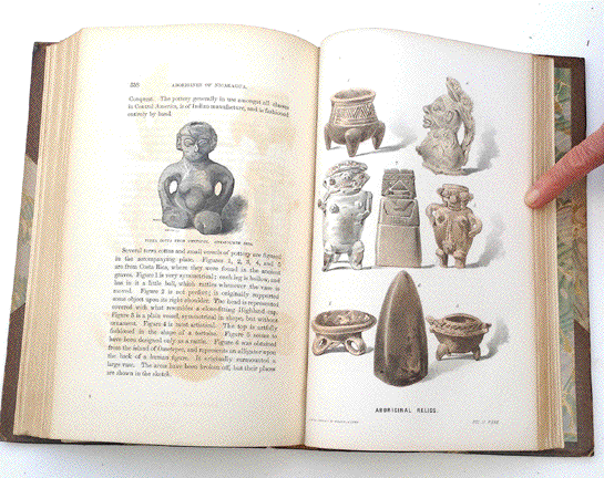
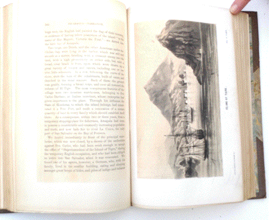
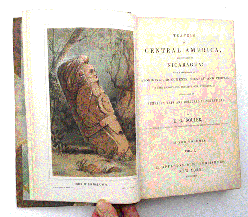
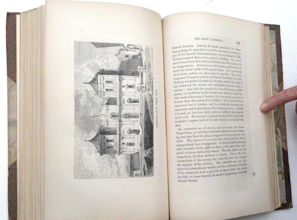
"Travels in Central America, Particularly in Nicaragua: With a Description of Its Aboriginal Monuments, Scenery and People, Their Languages, Institutions, Religion, & c., illustrated by numerous maps and coloured illustrations, by E. G. Squier, Late Charge-D'Affaires of the United States to the Republics of Central America"

Volumes I and II. Published by D. Appleton & Co., New York, 1853.
Volume I - 424 pages. Volume II - 452 pages Size. 8vo.

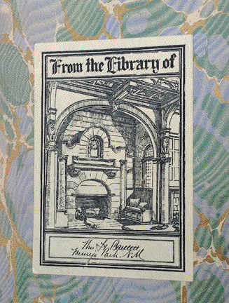
There is an Ex Libris (see photo) inside the cover from William H. Bartlett.
It was William H. Bartlett (1850-1918), a wealthy American business man purchased, in 1902, 205 000 acres of land near Vermejo in New Mexico from the Maxwell Land Grant Company.There he built three residences, one for himself and his wife, the Casa Grande, the other two for their two sons. Later he expanded this property to 300 000 acres. He named his vast possession The Vermejo Club, where, the most important business men regularly met and former US-presidents were guests as well as celebrities from Hollywood.
Bartlett owned an important and valuable library. For his "Ex Libris" sticker he used the fire place of his mansion, Casa Grande, for background decoration. Ted Turner bought the property in 1996. The Casa Grande is still standing, and as far as we know, Ted Turner is using it as his residence in Vermejo.

The set of two books we offer here were once part of Bartlett's library, which was dissolved after his death. Both volumes have Bartlett's original ãEx Libris". Please see photos.

Hardcover, partially leather. Both books are in good, solid condition with
signs of age and use on the covers. No loose pages. Texts and illustratons are in good, clean condition.
On the page before or after each illustration is a light brown
imprint from the colored lithograph. See photos.

Price for the two books: $ 600.00 NO DISCOUNT!!!

Order Nr. BOOK255795


Hablamos Español

Antique Prints of Central America

Maps of the Carribean

Maps of the World

PRINTS OF THE ENTIRE WORLD: Antique town and city views.

BOOKS

BOTANICAL PRINTS

BIRDS

MUSIC AND MUSICIANS

NUREMBERG CHRONICLE, LIBER CHRONARCUM, SCHEDELSCHE WELTCHRONIK

Ordering and Payment

E-mail

Terms of Sale - Lieferbedingungen

Home Page

Impressum

Datenschutz

© Rainer Rauhut